


Antique map of Perche and Blois by P. Mariette - ca. 1650
Antique map of Perche and Blois by P. Mariette - ca. 1650
Couldn't load pickup availability
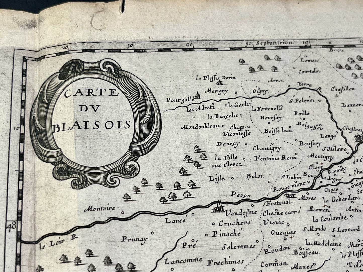
This antique map spanning Eure-et-Loir, Orne and Loir-et-Cher, representing Perche and Blésois, dates from the middle of the 17th century and measures 56.5 x 44 cm. It was published by P. Mariette.
Condition:
Center crease, tears and stains on the edges. Please note, my maps are old and are not always in perfect condition!
List of main cities represented:
Châteaudun, Brou, Illiers-Combray, La Bazoche-Gouet, Nogent-le-Rotrou, la Ferté-Bernard, Bellême, Mortagne-au-Perche, Verneuil-d'Avre-et-d'Iton, Senonches, Blois, Romorantin-Lanthenay, Selles-sur-Cher, Vatan, Vierzon, Bourges, la Ferté-Saint-Aubin, Beaugency, Meung-sur-Loire, Orléans, Vendôme,...


-

Secure payment
-

Careful shipping
-

No reproduction
-

Satisfied or refunded


-

“Hello, thank you for sending this, the cards are superb!”
Jean-Philippe
-
"They are very beautiful, just need to frame them! Thank you"
Baptiste
-
"Fast shipping and very good tracking."
Alice
-
"My husband loved the maps I gave him for Christmas!"
Solène
