


Antique map of Poitou by J. Rogier - ca. 1620
Antique map of Poitou by J. Rogier - ca. 1620
Couldn't load pickup availability
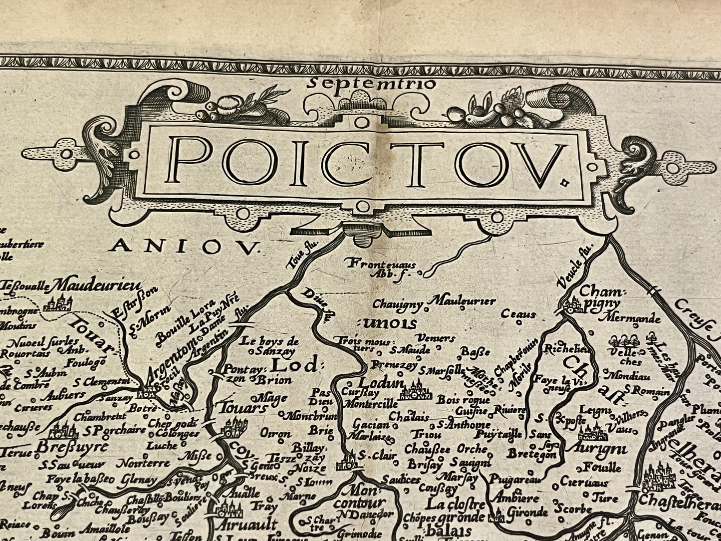
This antique map of Poitou dates from the beginning of the 17th century and measures 52.5x40cm. It was made in 1579 by Pierre Rogier, cartographer and lieutenant general of the Sénéchaussée of Melle, and published by M. Bouguereau and Jean Leclerc.
Condition:
Central crease, minor tears at the edge and a large stain on the lower left side. Please note, my maps are old and not always in perfect condition!
Main locations represented:
Saintes, Cognac, Île d'Oléron, Île de Ré, La Rochelle, Saint-Jean-d'Angély, Angoulême, Niort, Parthenay, Poitiers, Bressuire, Parthenay, Talmont-Saint-Hilaire, Les Sables d'Olonne, Chauvigny,...


-

Secure payment
-

Careful shipping
-

No reproduction
-

Satisfied or refunded


-

“Hello, thank you for sending this, the cards are superb!”
Jean-Philippe
-
"They are very beautiful, just need to frame them! Thank you"
Baptiste
-
"Fast shipping and very good tracking."
Alice
-
"My husband loved the maps I gave him for Christmas!"
Solène
