


Antique map of Ponthieu by J. Janssonius - ca. 1650
Antique map of Ponthieu by J. Janssonius - ca. 1650
Couldn't load pickup availability
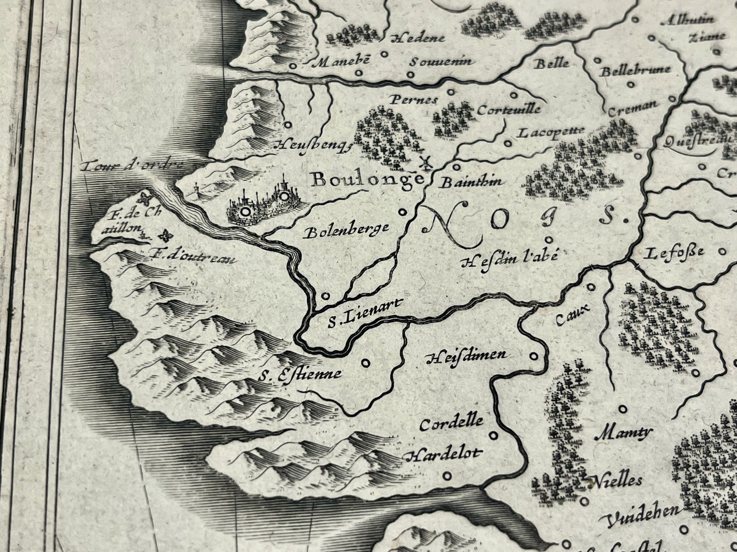
This antique map of Picardy represents the historic region of the County of Ponthieu, located between the Somme and Pas-de-Calais. Produced by the Dutch cartographer J. Janssonius, it dates from the mid-17th century and its dimensions are 56x44cm.
Condition:
Center crease, minimal stains and tears on edges. Please note, my maps are old and are not always in perfect condition!
List of main cities represented:
Boulogne-sur-Mer, Renty, Étaples, Montreuil-sur-Mer, Aire-sur-la-Lys, Béthune, Saint-Pol-sur-Ternoise, Rue, le Crotoy, Saint-Valéry-sur-Somme, Crécy-en-Ponthieu, Auxi-le-Château, Doullens, Arras, Saint-Riquier,...


-

Secure payment
-

Careful shipping
-

No reproduction
-

Satisfied or refunded


-

“Hello, thank you for sending this, the cards are superb!”
Jean-Philippe
-
"They are very beautiful, just need to frame them! Thank you"
Baptiste
-
"Fast shipping and very good tracking."
Alice
-
"My husband loved the maps I gave him for Christmas!"
Solène
