


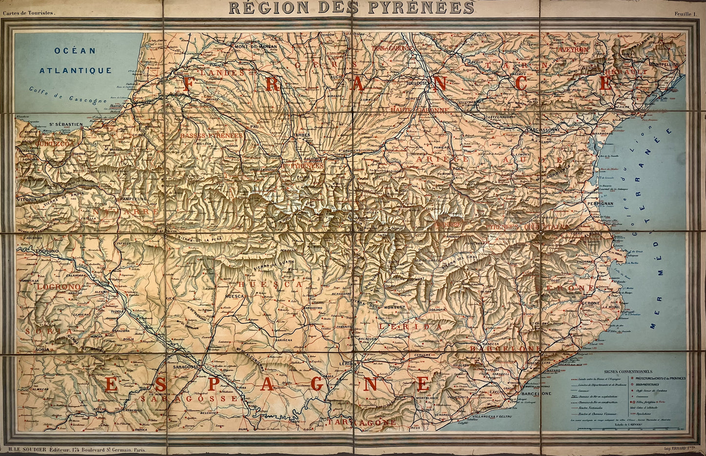
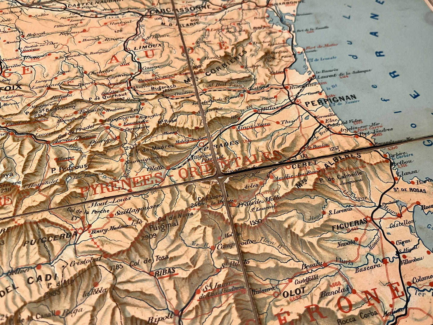
Antique map of the Pyrenees by H. le Soudier - ca. 1900
Antique map of the Pyrenees by H. le Soudier - ca. 1900
Regular price
170,00 €
Regular price
Sale price
170,00 €
Unit price
per
Taxes included.
Couldn't load pickup availability
This antique map depicts the French and Spanish Pyrenees. It was published by Henri le Soudier at the very beginning of the 20th century. It is canvas-backed and its unfolded dimensions are 93.5x60cm.
Condition:
Good condition, canvas worn in places. Please note, my maps are old and are not always in perfect condition!

-

Secure payment
-

Careful shipping
-

No reproduction
-

Satisfied or refunded


-

“Hello, thank you for sending this, the cards are superb!”
Jean-Philippe
-
"They are very beautiful, just need to frame them! Thank you"
Baptiste
-
"Fast shipping and very good tracking."
Alice
-
"My husband loved the maps I gave him for Christmas!"
Solène
