


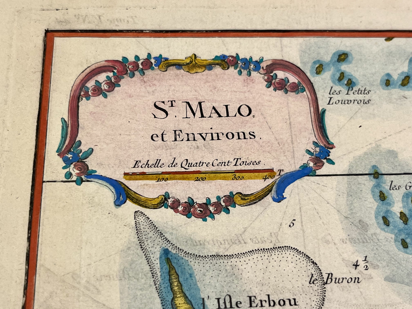
Antique map of Saint-Malo and its surroundings by JN Bellin - ca. 1760
Antique map of Saint-Malo and its surroundings by JN Bellin - ca. 1760
Regular price
210,00 €
Regular price
Sale price
210,00 €
Unit price
per
Taxes included.
Couldn't load pickup availability
This antique map of Ille-et-Vilaine depicts Saint-Malo and its surrounding area. It was drawn by Jean-Nicolas Bellin in the mid-18th century. It measures 44 x 31.5 cm.
Condition:
Center crease, minimal tears on edges. Please note, my maps are old and are not always in perfect condition!
List of main cities represented:
Saint-Malo, Dinard, Saint-Servan-sur-Mer


-

Secure payment
-

Careful shipping
-

No reproduction
-

Satisfied or refunded


-

“Hello, thank you for sending this, the cards are superb!”
Jean-Philippe
-
"They are very beautiful, just need to frame them! Thank you"
Baptiste
-
"Fast shipping and very good tracking."
Alice
-
"My husband loved the maps I gave him for Christmas!"
Solène
