


Antique map of Scotland, Isle of Lewis and Harris, by J. Blaeu - ca. 1650
Antique map of Scotland, Isle of Lewis and Harris, by J. Blaeu - ca. 1650
Regular price
300,00 €
Regular price
Sale price
300,00 €
Unit price
per
Taxes included.
Couldn't load pickup availability
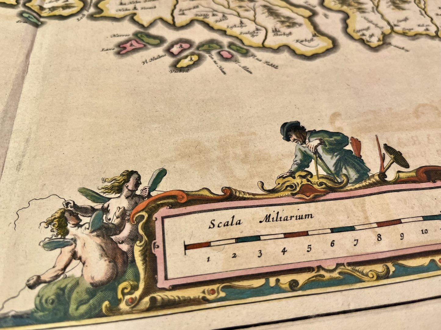
This antique map of the United Kingdom shows the Isle of Lewis and Harris in Scotland and was made and published by the Dutch cartographer J. Blaeu in the mid-17th century. Its colours are magnificent. Its size is 60x47cm.
Condition:
Repairs, significant central crease and minimal tear on the bottom of it. Please note, my maps are old and are not always in perfect condition!


-

Secure payment
-

Careful shipping
-

No reproduction
-

Satisfied or refunded


-

“Hello, thank you for sending this, the cards are superb!”
Jean-Philippe
-
"They are very beautiful, just need to frame them! Thank you"
Baptiste
-
"Fast shipping and very good tracking."
Alice
-
"My husband loved the maps I gave him for Christmas!"
Solène
