


Antique map of Sedan, Raucourt and Donchery by G. Blaeu - ca. 1630
Antique map of Sedan, Raucourt and Donchery by G. Blaeu - ca. 1630
Couldn't load pickup availability
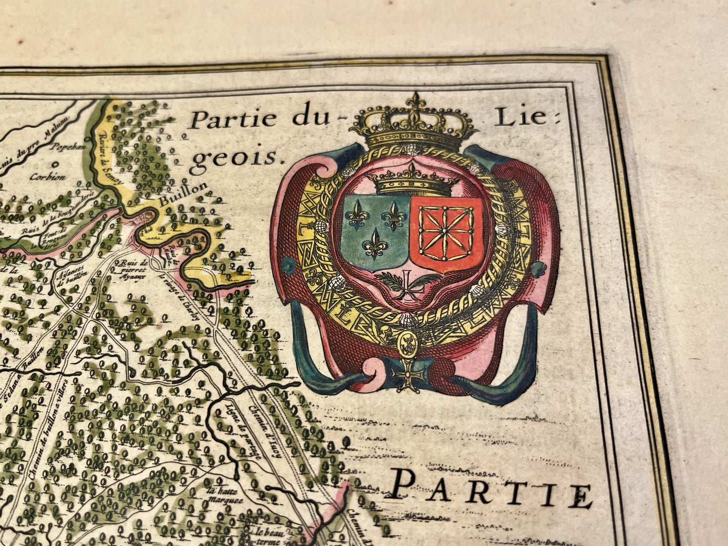
This antique map of the Ardennes representing the Sovereignties of Sedan and Raucourt and the Provostship of Donchery was made and published by the Dutch cartographer G. Blaeu in the middle of the 17th century. Its colors are magnificent. Its dimension is 61.5x51.5cm.
Condition:
Central fold. Please note, my maps are old and are not always in perfect condition!
List of towns and villages represented:
Chemery-sur-Bar, Raucourt-et-Flaba, Remilly-Aillicourt, Noyers-Pont-Maugis, Bazeilles, Sedan, Francheval, Douzy, Brevilly, Mairy, Glaire, Floing, Nouvion-sur-Meuse, Charleville-Mezieres, Bouillon,...


-

Secure payment
-

Careful shipping
-

No reproduction
-

Satisfied or refunded


-

“Hello, thank you for sending this, the cards are superb!”
Jean-Philippe
-
"They are very beautiful, just need to frame them! Thank you"
Baptiste
-
"Fast shipping and very good tracking."
Alice
-
"My husband loved the maps I gave him for Christmas!"
Solène
