


Antique map of the South Pole by JB. Bory de Saint-Vincent - ca. 1820
Antique map of the South Pole by JB. Bory de Saint-Vincent - ca. 1820
Regular price
140,00 €
Regular price
Sale price
140,00 €
Unit price
per
Taxes included.
Couldn't load pickup availability
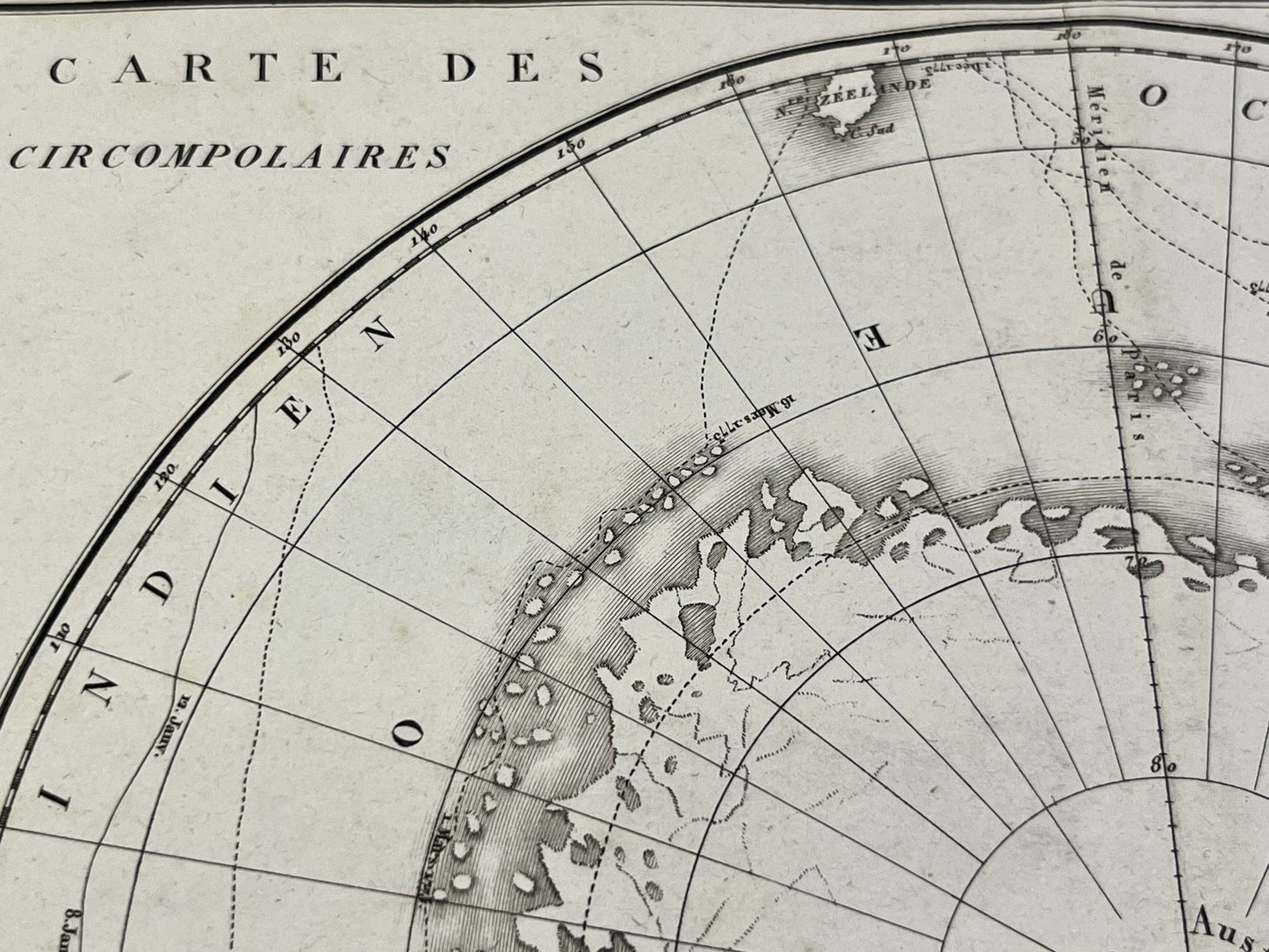
This antique map of the South Pole depicts the southern ice sheets and the circumpolar voyages of Cook, Furneaux, and Bouvet. It was drawn by J.B. Bory de Saint-Vincent in the early 19th century. The map measures 46x30.5cm.
Condition:
Minor stains, central crease. Please note, my maps are old and not always in perfect condition!


-

Secure payment
-

Careful shipping
-

No reproduction
-

Satisfied or refunded


-

“Hello, thank you for sending this, the cards are superb!”
Jean-Philippe
-
"They are very beautiful, just need to frame them! Thank you"
Baptiste
-
"Fast shipping and very good tracking."
Alice
-
"My husband loved the maps I gave him for Christmas!"
Solène
