


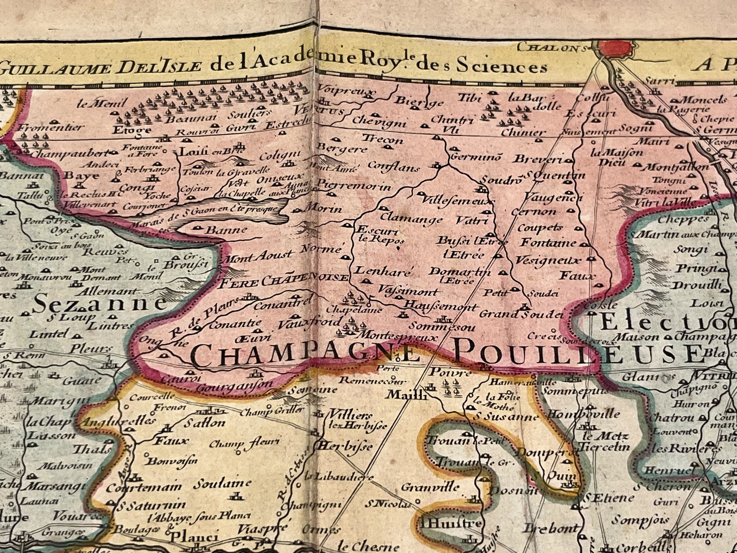
Antique map of southern Champagne by G. Delisle - 1713
Antique map of southern Champagne by G. Delisle - 1713
Couldn't load pickup availability
This antique map of Champagne depicts its southern part. It was drawn and published by Guillaume Delisle in 1713. It measures 70.5x52cm. Beautiful period colors.
Condition:
Center fold, minimal tear on the lower part of it and minimal stains. Please note, my maps are old and are not always in perfect condition!
List of main cities represented:
Langres, Chaumont, Bar-sur-Aube, Bar-sur-Seine, Joinville, Bar-le-Duc, Vitry-le-François, Saint-Dizier, Chalons-en-Champagne, Tonnerre, Auxerre, Saint-Florentin, Joigny, Chaource, Troyes, Romilly-sur-Seine, Nogent-sur-Seine, Sens, Arcis-sur-Aube, Provins, Sens,...


-

Secure payment
-

Careful shipping
-

No reproduction
-

Satisfied or refunded


-

“Hello, thank you for sending this, the cards are superb!”
Jean-Philippe
-
"They are very beautiful, just need to frame them! Thank you"
Baptiste
-
"Fast shipping and very good tracking."
Alice
-
"My husband loved the maps I gave him for Christmas!"
Solène
