


Antique map of southern Champagne by G. Robert de Vaugondy - 1752
Antique map of southern Champagne by G. Robert de Vaugondy - 1752
Couldn't load pickup availability
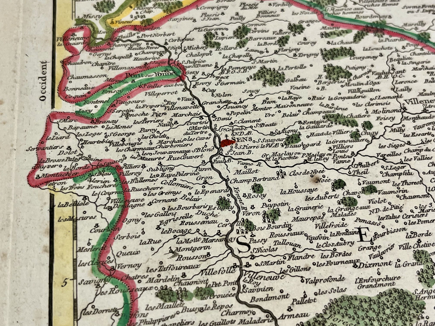
This antique map of southern Champagne partly covers the current departments of Aube, Yonne and Haute-Marne. It was drawn up and published by Gilles Robert de Vaugondy in 1752. Its dimensions are 78x55cm.
Condition:
Center crease and minimal staining. Please note, my maps are old and are not always in perfect condition!
List of main cities represented:
Joigny, Saint-Florentin, Aix-en-Othe, Provins, Nogent-sur-Seine, Arcis-sur-Aube, Troyes, Châtillon-sur-Seine, Montbard, Langres, Bar-sur-Seine, Bar-sur-Aube, Brienne-le-Château, Saint-Dizier, Vitry-le-François, Sens, Bar-le-Duc, Chaource,...
List of former regions represented:
Champagne, Vallage, Bassigny, Senonois, Brie, Perthois


-

Secure payment
-

Careful shipping
-

No reproduction
-

Satisfied or refunded


-

“Hello, thank you for sending this, the cards are superb!”
Jean-Philippe
-
"They are very beautiful, just need to frame them! Thank you"
Baptiste
-
"Fast shipping and very good tracking."
Alice
-
"My husband loved the maps I gave him for Christmas!"
Solène
