


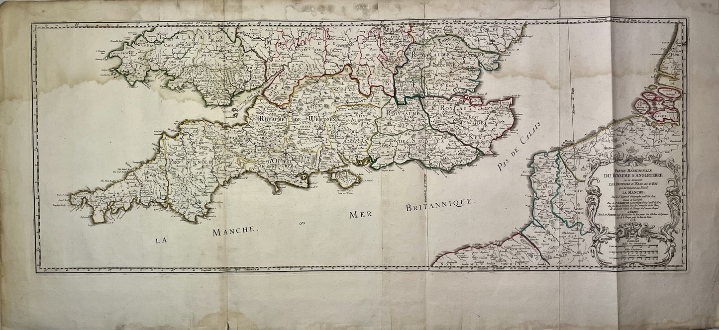
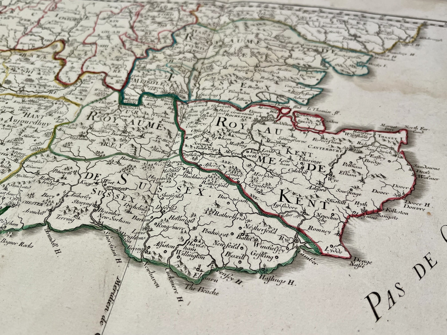
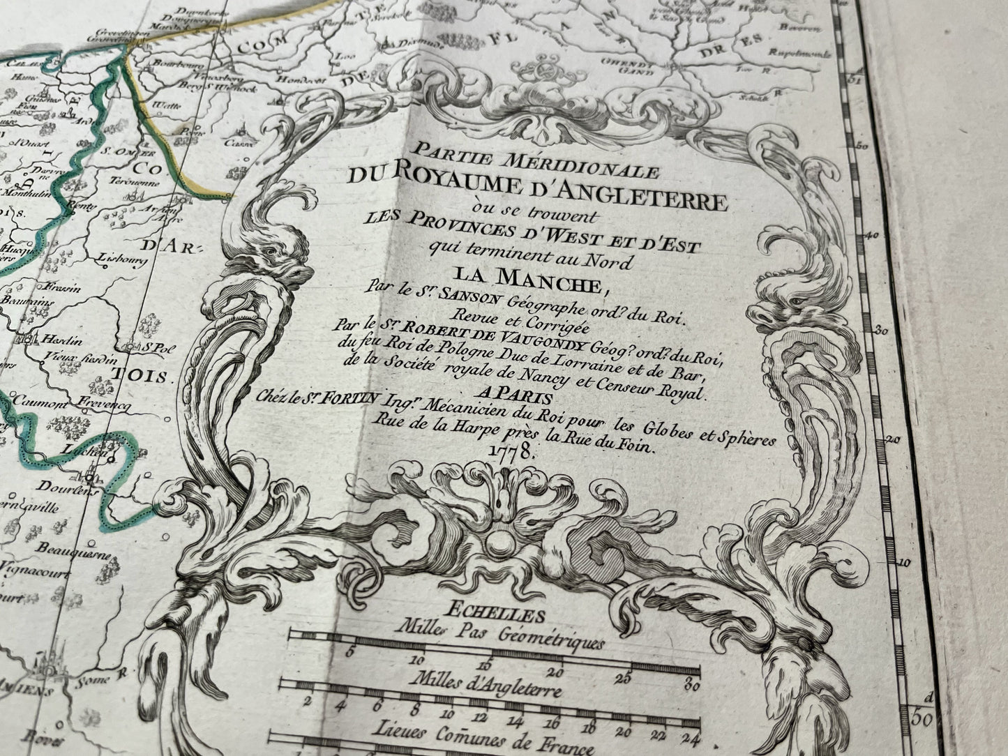
Antique map of the southern part of England by N. Sanson - 1778
Antique map of the southern part of England by N. Sanson - 1778
Regular price
100,00 €
Regular price
Sale price
100,00 €
Unit price
per
Taxes included.
Couldn't load pickup availability
This antique map of southern England was produced by Nicolas Sanson d'Abbeville and published within the Atlas Britannique by his great-grandson, Didier Robert de Vaugondy, in 1778. Its dimensions are 105.5x49.5cm.
Condition:
Significant creases and moisture stains. Please note, my maps are old and are not always in perfect condition!
-

Secure payment
-

Careful shipping
-

No reproduction
-

Satisfied or refunded


-

“Hello, thank you for sending this, the cards are superb!”
Jean-Philippe
-
"They are very beautiful, just need to frame them! Thank you"
Baptiste
-
"Fast shipping and very good tracking."
Alice
-
"My husband loved the maps I gave him for Christmas!"
Solène
