


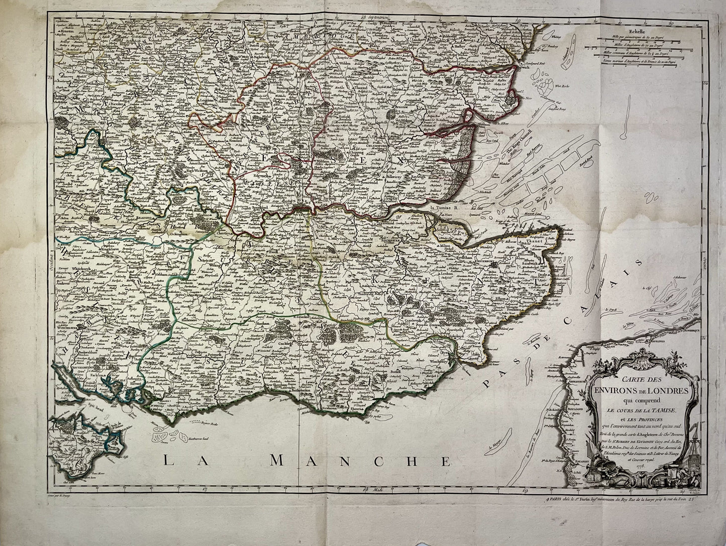
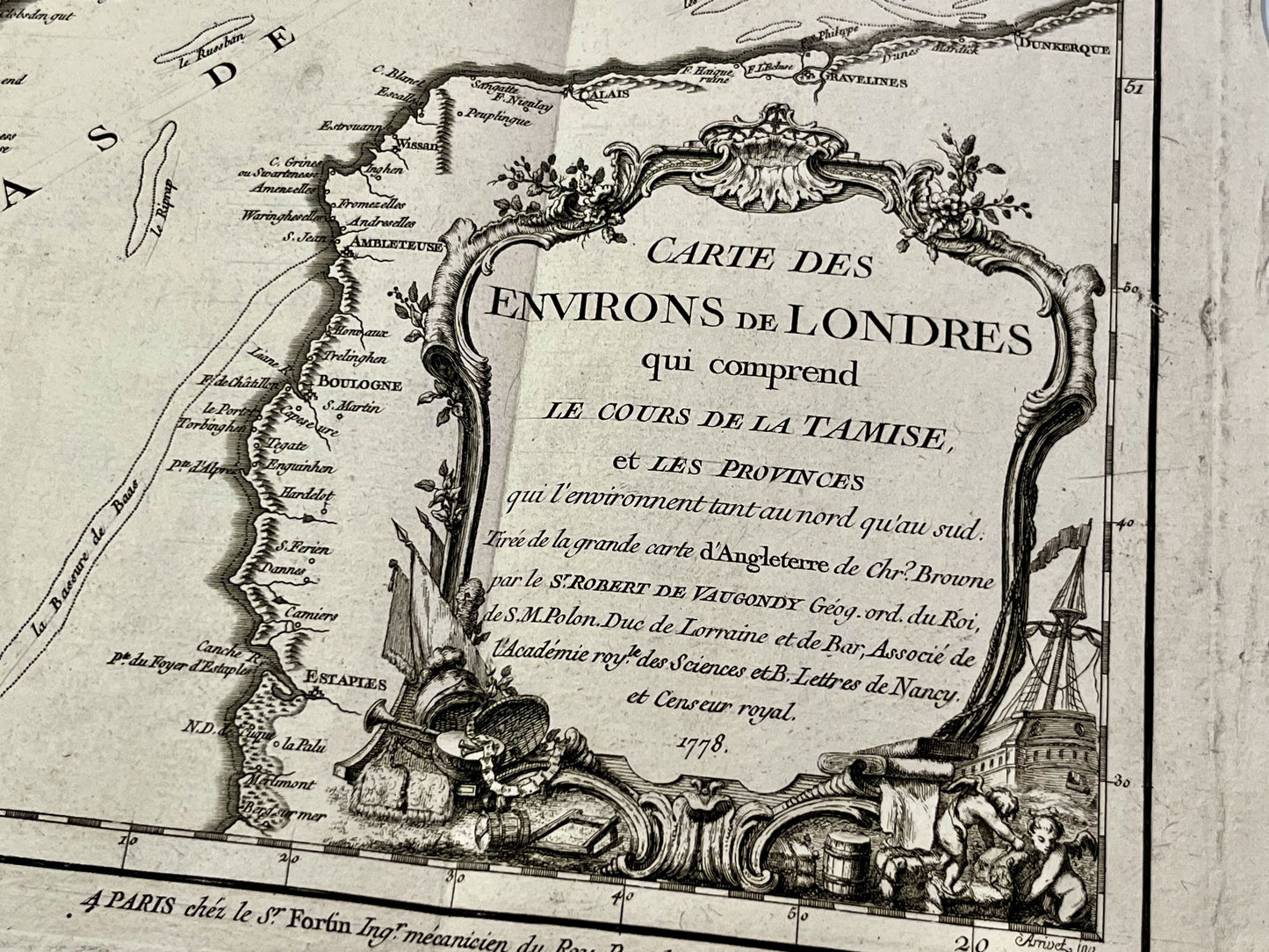
Antique map of the surroundings of London by C. Browne - 1778
Antique map of the surroundings of London by C. Browne - 1778
Regular price
120,00 €
Regular price
Sale price
120,00 €
Unit price
per
Taxes included.
Couldn't load pickup availability
This antique map of England showing the area around London was produced by Christopher Browne and published in the Atlas Britannique by Didier Robert de Vaugondy, in 1778. Its dimension is 74.5x57cm.
Condition:
Significant creases and moisture stains. Please note, my maps are old and are not always in perfect condition!

-

Secure payment
-

Careful shipping
-

No reproduction
-

Satisfied or refunded


-

“Hello, thank you for sending this, the cards are superb!”
Jean-Philippe
-
"They are very beautiful, just need to frame them! Thank you"
Baptiste
-
"Fast shipping and very good tracking."
Alice
-
"My husband loved the maps I gave him for Christmas!"
Solène
