


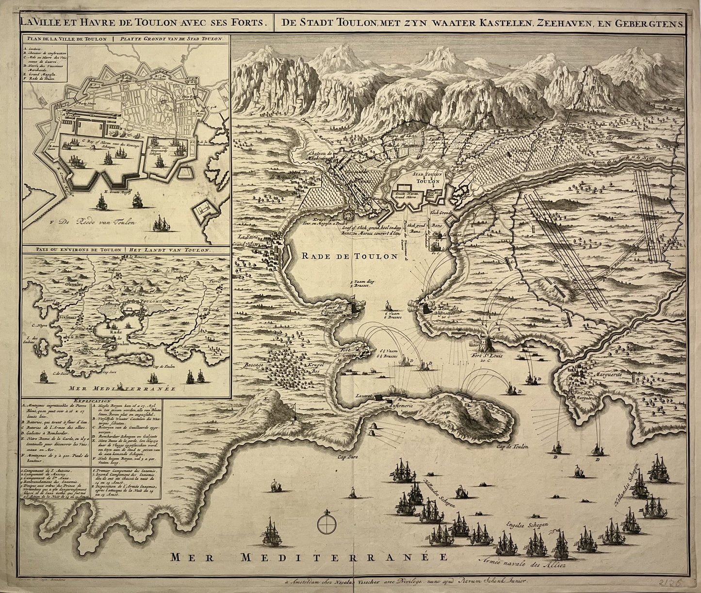
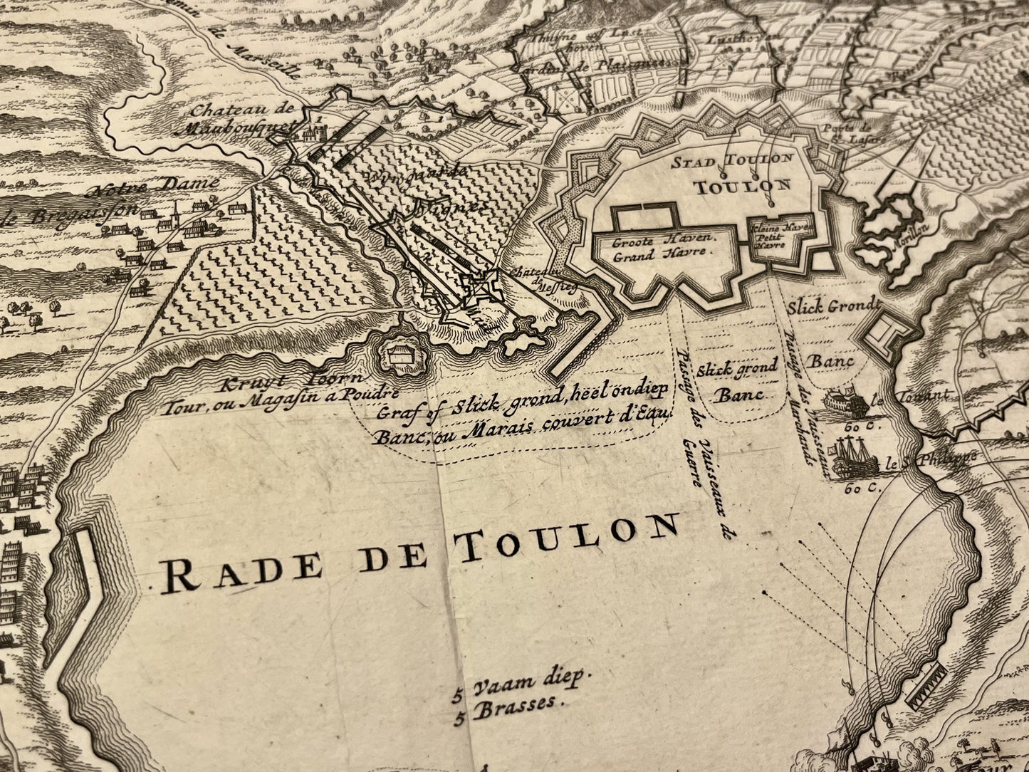
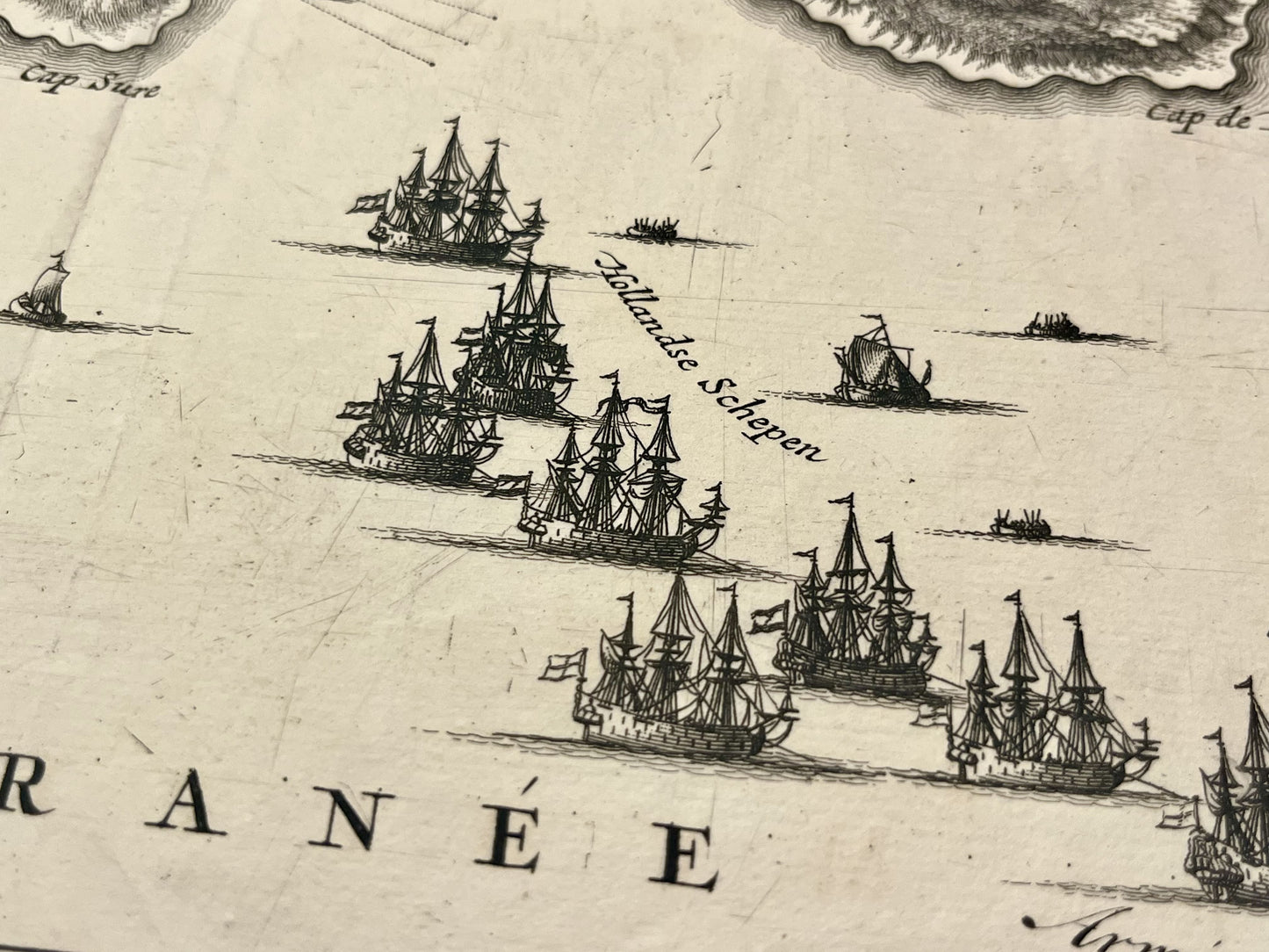
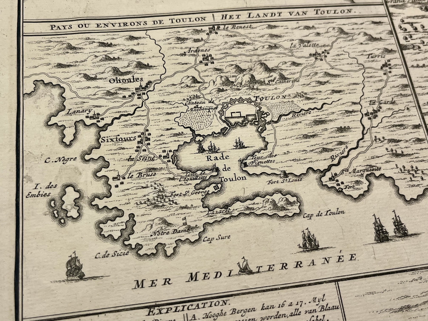
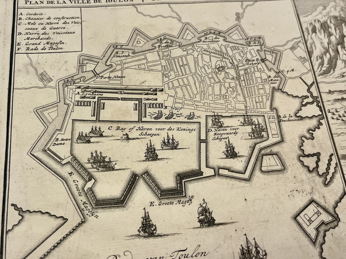
Antique map of the harbor of Toulon during the siege of 1707 by N. Visscher - ca. 1710
Antique map of the harbor of Toulon during the siege of 1707 by N. Visscher - ca. 1710
Regular price
460,00 €
Regular price
Sale price
460,00 €
Unit price
per
Taxes included.
Couldn't load pickup availability
This antique map of Toulon Harbor depicting the siege of 1707 dates from the early 18th century and measures 59x50cm. It was published by the Dutch cartographer N. Visscher.
Condition:
Fold in the center and tear on the lower part. Please note, my maps are old and are not always in perfect condition!
List of main cities represented:
La Seyne-sur-Mer, Saint-Mandrier-sur-Mer,...
-

Secure payment
-

Careful shipping
-

No reproduction
-

Satisfied or refunded


-

“Hello, thank you for sending this, the cards are superb!”
Jean-Philippe
-
"They are very beautiful, just need to frame them! Thank you"
Baptiste
-
"Fast shipping and very good tracking."
Alice
-
"My husband loved the maps I gave him for Christmas!"
Solène
