


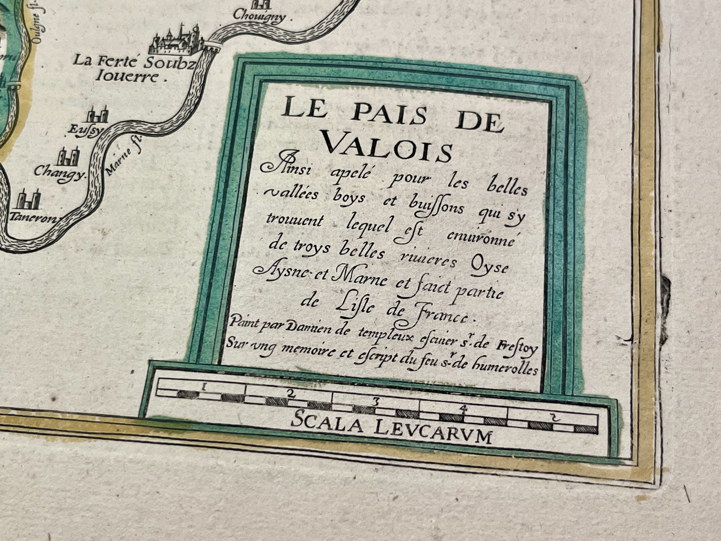
Antique map of the Valois region by D. de Templeux - ca. 1630
Antique map of the Valois region by D. de Templeux - ca. 1630
Couldn't load pickup availability
This antique map of Île-de-France, depicting the Valois region, dates from the mid-17th century and measures 61x46cm. It was published by Damien de Templeux.
Condition:
Central crease and significant stains (see photos). Please note, my maps are old and not always in perfect condition!
Main cities represented:
Senlis, Pont-Sainte-Maxence, Creil, Compiègne, La Ferté-Millon, Crépy-en-Valois, Villers-Cotterêts,...


-

Secure payment
-

Careful shipping
-

No reproduction
-

Satisfied or refunded


-

“Hello, thank you for sending this, the cards are superb!”
Jean-Philippe
-
"They are very beautiful, just need to frame them! Thank you"
Baptiste
-
"Fast shipping and very good tracking."
Alice
-
"My husband loved the maps I gave him for Christmas!"
Solène
