


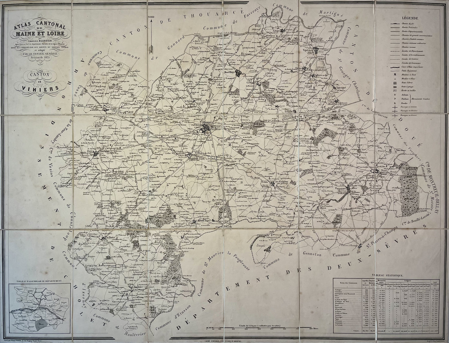
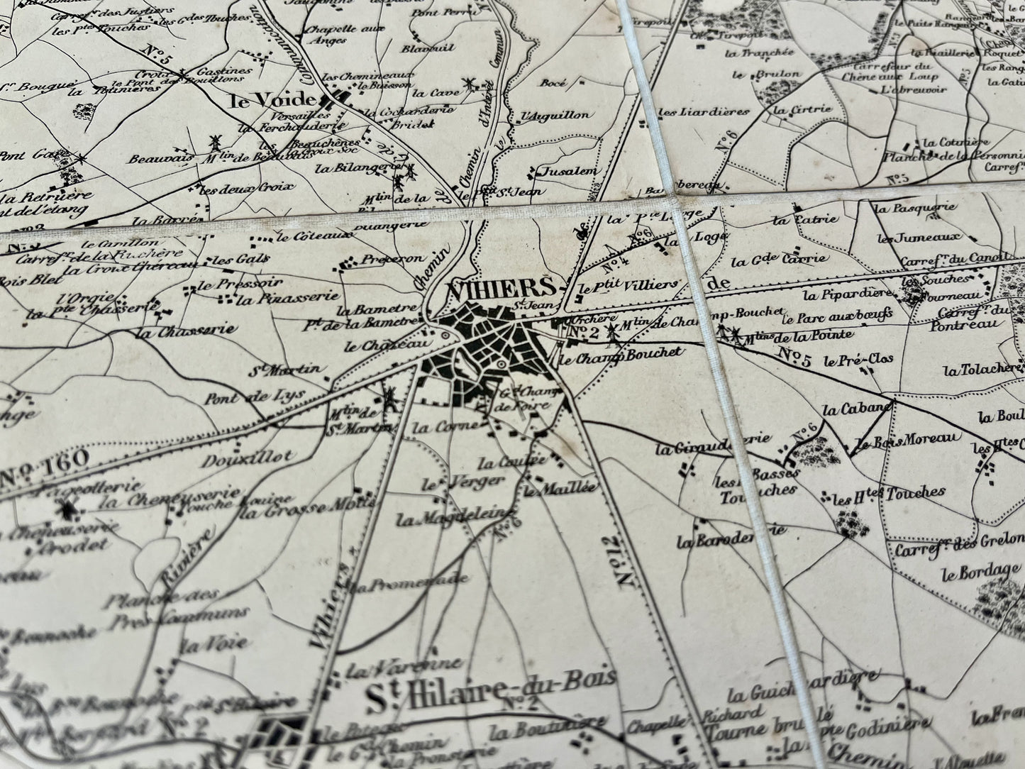
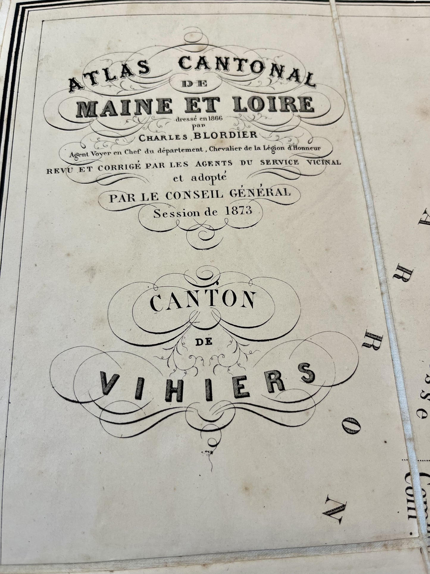
Antique map of Vihiers and its surroundings by Charles Blordier - 1873
Antique map of Vihiers and its surroundings by Charles Blordier - 1873
Couldn't load pickup availability
This antique canvas map of the Canton of Vihiers comes from the Atlas Cantonal de Maine-et-Loire and was drawn up by Charles Blordier. It is dated 1873 and its unfolded dimension is 82x62.5cm.
Condition:
Very good condition. Please note, my maps are old and are not always in perfect condition!
List of main villages represented:
Somloire, la Plaine, Saint-Paul-du-Bois, Saint-Hilaire-du-Bois, Coron, La-Salle-de-Vihiers, le Cerqueux-sous-Passavant, Passavant, Cléré, Vihiers, le Voide, Montilliers, Nueil, Tancoigné, Trémont, Cernusson, Tigné, Aubigné, Amigné.
-

Secure payment
-

Careful shipping
-

No reproduction
-

Satisfied or refunded


-

“Hello, thank you for sending this, the cards are superb!”
Jean-Philippe
-
"They are very beautiful, just need to frame them! Thank you"
Baptiste
-
"Fast shipping and very good tracking."
Alice
-
"My husband loved the maps I gave him for Christmas!"
Solène
