


Antique nautical chart of Galway Bay and the Limerick River - ca. 1750
Antique nautical chart of Galway Bay and the Limerick River - ca. 1750
Regular price
215,30 €
Regular price
Sale price
215,30 €
Unit price
per
Taxes included.
Couldn't load pickup availability
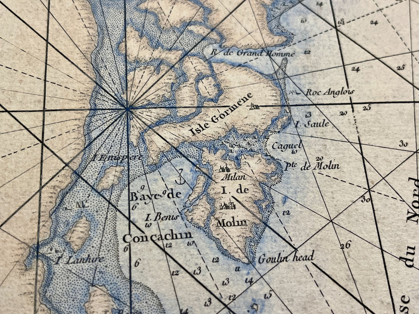
This antique nautical chart depicting the west coast of Ireland, including Galway Bay and the Limerick River, was produced by the Dépôt Général de la Marine. It dates from the mid-18th century and measures 98x66cm.
Condition:
Central crease, stains and tears on the edges. Please note, my maps are old and not always in perfect condition!


-

Secure payment
-

Careful shipping
-

No reproduction
-

Satisfied or refunded


-

“Hello, thank you for sending this, the cards are superb!”
Jean-Philippe
-
"They are very beautiful, just need to frame them! Thank you"
Baptiste
-
"Fast shipping and very good tracking."
Alice
-
"My husband loved the maps I gave him for Christmas!"
Solène
