


Antique nautical chart from Saint-Tropez to Menton
Antique nautical chart from Saint-Tropez to Menton
Couldn't load pickup availability
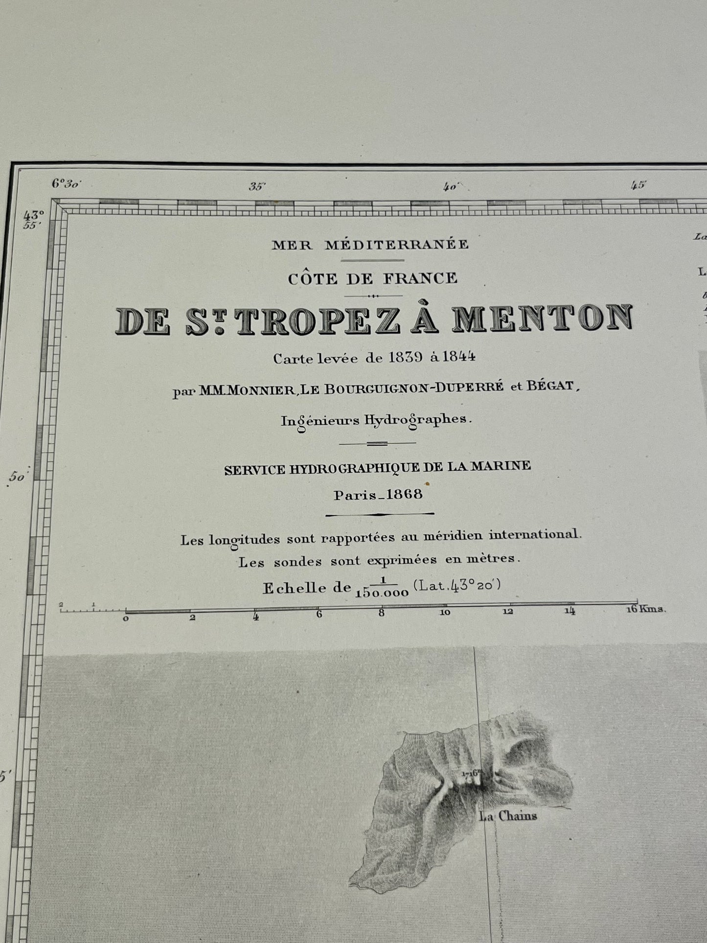
This antique nautical chart of the Mediterranean coast from Saint-Tropez to Menton was produced by the Service Hydrographique de la Marine. It dates from the mid-20th century and its dimensions are 105.5x74cm.
Condition:
Good condition, central crease. Please note, my maps are old and not always in perfect condition!
Main cities represented:
Ramatuelle, Cavalaire-sur-Mer, Saint-Tropez, Fréjus, Saint-Raphaël, Cannes, Antibes, Nice, Saint-Jean-Cap-Ferrat, Monaco, Menton, Sainte-Maxime


-

Secure payment
-

Careful shipping
-

No reproduction
-

Satisfied or refunded


-

“Hello, thank you for sending this, the cards are superb!”
Jean-Philippe
-
"They are very beautiful, just need to frame them! Thank you"
Baptiste
-
"Fast shipping and very good tracking."
Alice
-
"My husband loved the maps I gave him for Christmas!"
Solène
