


Antique map of the tidal currents of the English Channel
Antique map of the tidal currents of the English Channel
Couldn't load pickup availability
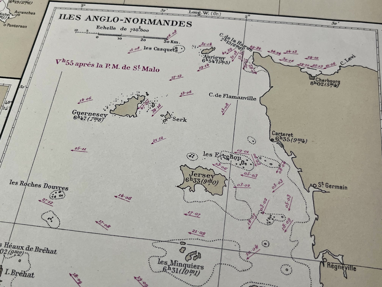
This antique nautical chart depicting the tidal currents of the English Channel was produced by the French Service Hydrographique de la Marine. It includes specific maps of the approaches to Le Havre, the harbors of Cherbourg and Brest, and the Channel Islands. It dates from the mid-20th century and measures 74.5x53cm.
Condition:
Good condition. Please note, my maps are old and not always in perfect condition!


-

Secure payment
-

Careful shipping
-

No reproduction
-

Satisfied or refunded


-

“Hello, thank you for sending this, the cards are superb!”
Jean-Philippe
-
"They are very beautiful, just need to frame them! Thank you"
Baptiste
-
"Fast shipping and very good tracking."
Alice
-
"My husband loved the maps I gave him for Christmas!"
Solène
