


Antique map of Abyssinia Daily Herald by SJ Turner - 1935
Antique map of Abyssinia Daily Herald by SJ Turner - 1935
Couldn't load pickup availability
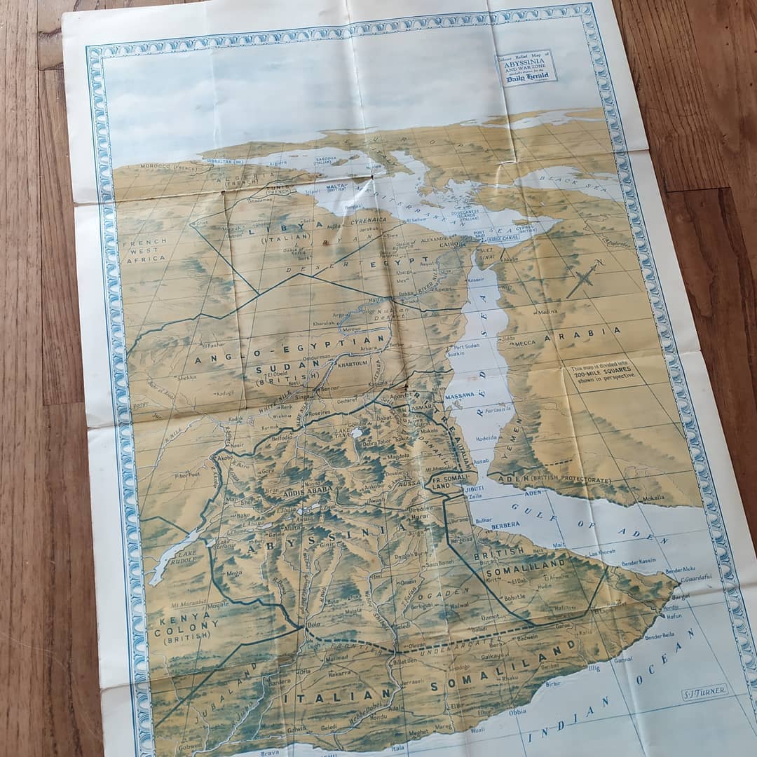
This color relief map, titled "Color Relief Map of Abyssinia and War Zone specially drawn for the Daily Herald," was created by S.J. Turner and published in London in 1935. It offers a "bird's eye view" of East Africa extending to the Mediterranean. The historical context is essential: the map was published just before Italy's invasion of Ethiopia and illustrates the political divisions of the Horn of Africa at that time. It shows Abyssinia as a still-independent country, bordered by colonial territories: Anglo-Egyptian Sudan, the Colony of Kenya, and British Somaliland under British control, and Italian Somaliland, Libya, and Eritrea under Italian control. The map uses shaded relief to indicate the topography of mountainous regions. A notable feature is the use of a grid scale where each side of a square represents approximately 200 miles, as shown on the map. Although the publication predates the founding of Italian East Africa (in 1936), it captures the region just as the conflict began. The map measures 51 cm by 76 cm.
Condition :
Good condition, some flaws (holes) at the folds. Please note, my maps are old and are not always in perfect condition!
List of main places represented:
Abyssinia (Ethiopia), Anglo-Egyptian Sudan, Egypt, Libya (Italian), Arabia, Italian Somaliland, British Somaliland, French Somaliland, Colony of Kenya, Red Sea, Gulf of Aden, Addis Ababa, Khartoum, Asmara, Suez Canal.


-

Secure payment
-

Careful shipping
-

No reproduction
-

Satisfied or refunded


-

“Hello, thank you for sending this, the cards are superb!”
Jean-Philippe
-
"They are very beautiful, just need to frame them! Thank you"
Baptiste
-
"Fast shipping and very good tracking."
Alice
-
"My husband loved the maps I gave him for Christmas!"
Solène
