


Old and illustrated map of Finland - 1949
Old and illustrated map of Finland - 1949
Couldn't load pickup availability
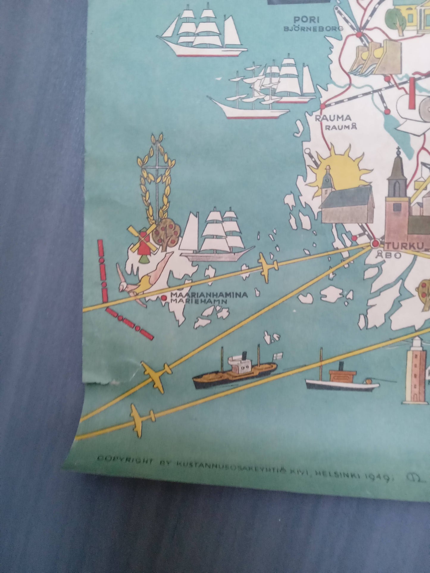
This pictorial map of Finland, titled "Finland Suomi," is a richly illustrated geographical representation of the country in 1949. It highlights major cities, roads, and railways. Numerous colorful vignettes depict economic activities, local wildlife, and traditions. There are scenes of industry, agriculture, and cattle ranching, as well as illustrations of reindeer, bears, and skiers, particularly in the northern part of the country. Maritime and air connections are also represented by ships, sailboats, and airplanes. In the upper right corner, an inset locates Finland in Europe. The Finnish coat of arms is attractively displayed next to the title. The map measures 84 cm by 47 cm.
Condition :
Good condition (see photo). Please note, my maps are old and are not always in perfect condition!
List of main places represented:
Helsinki (Helsingfors), Turku (Åbo), Tampere (Tammerfors), Lahti, Porvoo (Borgå), Kotka, Savonlinna, Kuopio, Iisalmi, Vaasa, Oulu (Uleåborg), Kemi, Rovaniemi, Maarianhamina (Mariehamn), Pori (Björneborg), Rauma (Raumo).


-

Secure payment
-

Careful shipping
-

No reproduction
-

Satisfied or refunded


-

“Hello, thank you for sending this, the cards are superb!”
Jean-Philippe
-
"They are very beautiful, just need to frame them! Thank you"
Baptiste
-
"Fast shipping and very good tracking."
Alice
-
"My husband loved the maps I gave him for Christmas!"
Solène
