


Old map of Roussillon by LC. Desnos - 1766
Old map of Roussillon by LC. Desnos - 1766
Couldn't load pickup availability
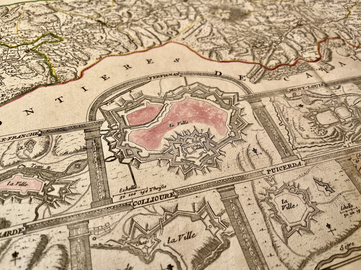
This old map of Roussillon "subdivided into Cerdagne, Cap Sir, Conflans, Vals de Carol and Spir, where Lampourdan is still located, part of Catalonia" was made by LC. Desnos, is dated 1766 and the size of the sheet is 79x54cm. It is decorated with a very beautiful cartouche and detailed plans of the cities of Perpignan, Villefranche, Mont-Louis, Roses, Puicerda, Collioure and Bellegarde. Its contours are colored from the period.
State :
Moisture stains on edges, crease in center and tears on edges. Please note, my cards are old and are not always in perfect condition!


-

Secure payment
-

Careful shipping
-

No reproduction
-

Satisfied or refunded


-

“Hello, thank you for sending this, the cards are superb!”
Jean-Philippe
-
"They are very beautiful, just need to frame them! Thank you"
Baptiste
-
"Fast shipping and very good tracking."
Alice
-
"My husband loved the maps I gave him for Christmas!"
Solène
