


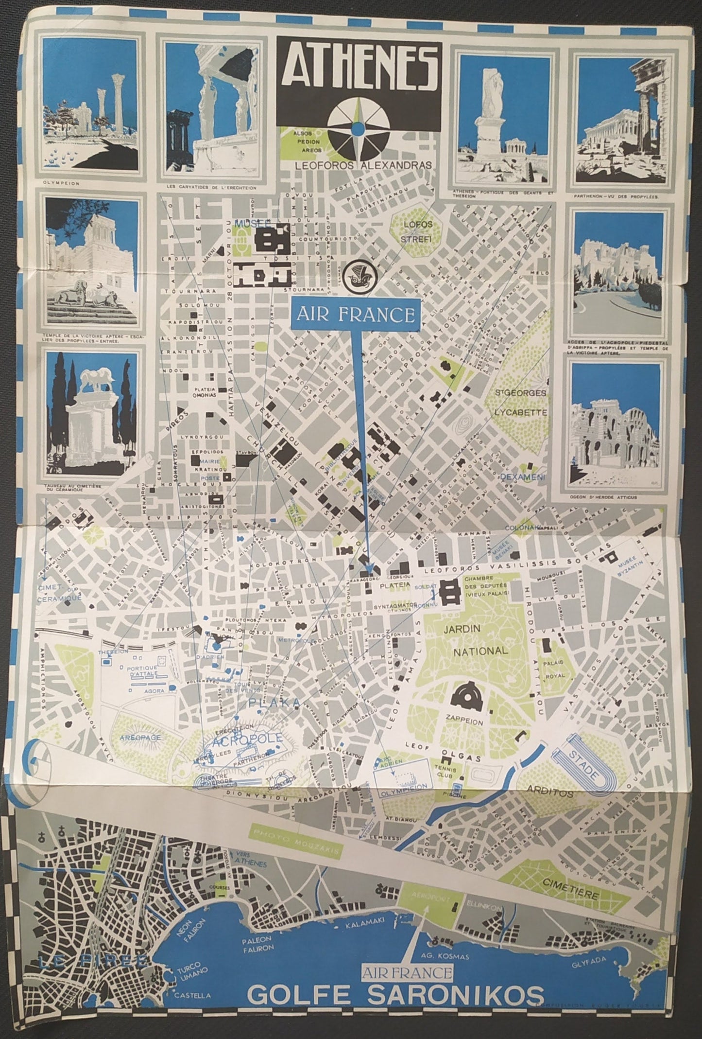
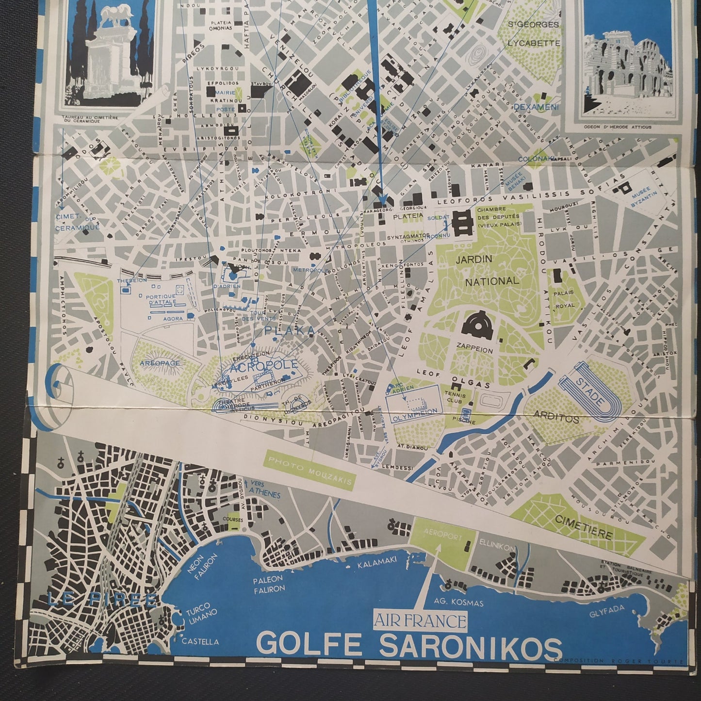
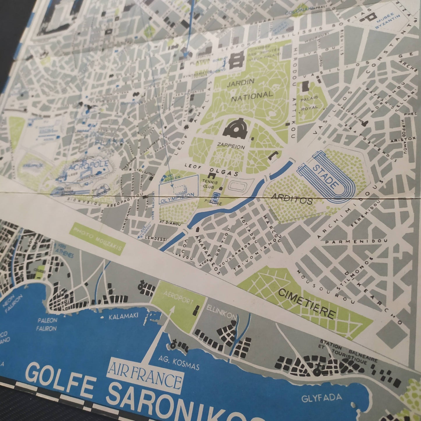
Map of Athens by Air France - 1960s
Map of Athens by Air France - 1960s
Couldn't load pickup availability
This 1960s tourist map of Athens, published by Air France, features a detailed plan of the city with its main streets and points of interest. The map is adorned with illustrations of famous Athens monuments, such as the Parthenon and other historical sites. It also includes information on important places like the National Garden and directions for travelers. The map is bordered with color images of the city's iconic sites. Ideal for travel and vintage cartography enthusiasts, it offers a glimpse of the city at that time. Dimensions: 42 x 28 cm
Condition :
Very good condition. Please note, my maps are old and not always in perfect condition!

-

Secure payment
-

Careful shipping
-

No reproduction
-

Satisfied or refunded


-

“Hello, thank you for sending this, the cards are superb!”
Jean-Philippe
-
"They are very beautiful, just need to frame them! Thank you"
Baptiste
-
"Fast shipping and very good tracking."
Alice
-
"My husband loved the maps I gave him for Christmas!"
Solène
