


Map of Special Regional Beers of Belgium - 1954
Map of Special Regional Beers of Belgium - 1954
Couldn't load pickup availability
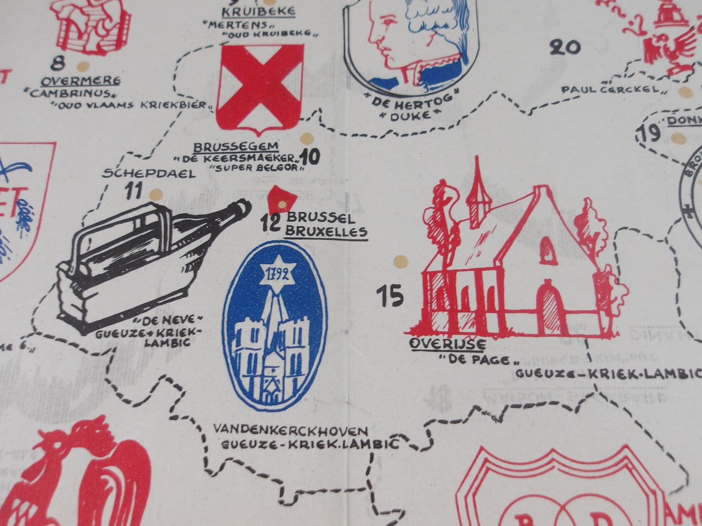
This illustrated map of Regional Special Beers, published in 1954 by the Community of Regional Special Beers, measures 54 x 40 cm. It depicts the main breweries and their specific beers across Belgium. In a rich and colorful graphic style, the map combines geographical landmarks, decorative elements, and scenes of local life: traditional characters, monuments, and regional symbols punctuate the landscape, offering a picturesque and cultural vision of the region. This representation aimed as much to promote regional beers as to convey an image of diversity and Belgian brewing tradition. Produced for communication and promotional purposes, it is today an emblematic document of Belgian advertising graphic productions of the time.
Condition :
Very good condition. Please note, this maps is old and may show signs of wear normal for its age!
List of main places represented:
Assenede, Deurne, Hasselt, Mons, Tourpes, Arlon, Bruges, Ghent, Kruibeke, Murr, Verviers, Dinant, Brussels, Geel, Liège, Nechin, Antwerp, Deinze, Louvain, Overmère, Pipaix, Saint-Gérard, De Hertog, Mechelen, Schepdael


-

Secure payment
-

Careful shipping
-

No reproduction
-

Satisfied or refunded


-

“Hello, thank you for sending this, the cards are superb!”
Jean-Philippe
-
"They are very beautiful, just need to frame them! Thank you"
Baptiste
-
"Fast shipping and very good tracking."
Alice
-
"My husband loved the maps I gave him for Christmas!"
Solène
