


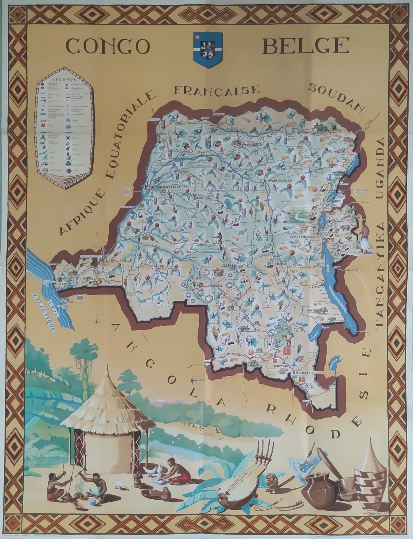
Illustrated map of the Belgian Congo by Fans Laboulais - 1949
Illustrated map of the Belgian Congo by Fans Laboulais - 1949
Couldn't load pickup availability
This illustrated map of the Belgian Congo, created by Fans Laboulais in 1949, offers a detailed and artistic representation of the region. The map is framed by a decorative pattern with geometric elements and cultural illustrations, including huts, local characters, and animals. The territory is depicted with topographical details and symbols indicating cities, rivers, and points of interest. The names of neighboring regions, such as French Equatorial Africa, Sudan, Uganda, Tanganyika, and Angola, are also shown. The map includes an emblem of the Belgian Congo at the top. It offers a rich and colorful overview of the region at that time. Dimensions: 118 x 85 cm.
Condition:
Good condition. Please note, my maps are old and not always in perfect condition!
List of main places represented:
Belgian Congo, Leopoldville, Stanleyville, Elisabethville, Boma, Matadi, Coquilhatville, Luluabourg, Kasai, Congo, Lake Leopold II, Stanley Pool, French Equatorial Africa, Sudan, Uganda, Tanganyika, Rhodesia, Central Africa, Africa.


-

Secure payment
-

Careful shipping
-

No reproduction
-

Satisfied or refunded


-

“Hello, thank you for sending this, the cards are superb!”
Jean-Philippe
-
"They are very beautiful, just need to frame them! Thank you"
Baptiste
-
"Fast shipping and very good tracking."
Alice
-
"My husband loved the maps I gave him for Christmas!"
Solène
