


Map of the U.S. 83rd Infantry Division in Europe - ca. 1940
Map of the U.S. 83rd Infantry Division in Europe - ca. 1940
Couldn't load pickup availability
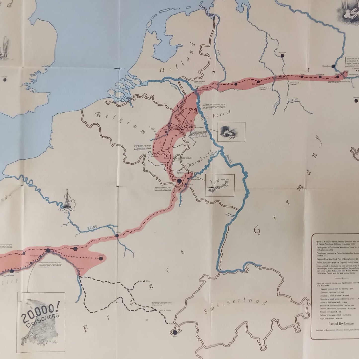
This poster is a map detailing the routes and milestones of the 83rd US Infantry Division during World War II, from its arrival in Europe until the end of the conflict. The route is highlighted by a red line, with shaded areas to mark important regions of operations. The edges feature the division's major milestones, including "NORMANDY – BRITTANY – ST. MALO – LOIRE VALLEY – LUXEMBOURG" at the top, and "HURTGEN FOREST – THE ARDENNES – NEUSS – HARZ MOUNTAINS – ELBE RIVER" at the bottom. A division badge is visible in the lower left corner. A small legend in the lower right corner provides information about the division and its campaigns. An illustration reads "20,000! PRISONERS" in the Loire Valley region. This historical and commemorative map is a visual representation of the division's efforts. The card measures 87.5 cm by 72.5 cm.
Condition :
Good condition Please note, my maps are old and are not always in perfect condition! The condition is average, with holes in some folds, but the map remains very beautiful (and rare).
List of main places represented:
England Wales Normandy Brittany Saint-Malo Loire Valley Luxembourg Hürtgen Forest Ardennes Neuss Harz Mountains Elbe River Holland Belgium Germany Switzerland Italy France


-

Secure payment
-

Careful shipping
-

No reproduction
-

Satisfied or refunded


-

“Hello, thank you for sending this, the cards are superb!”
Jean-Philippe
-
"They are very beautiful, just need to frame them! Thank you"
Baptiste
-
"Fast shipping and very good tracking."
Alice
-
"My husband loved the maps I gave him for Christmas!"
Solène
