


Map of the Port of Marseille and its annexes - ca. 1950
Map of the Port of Marseille and its annexes - ca. 1950
Couldn't load pickup availability
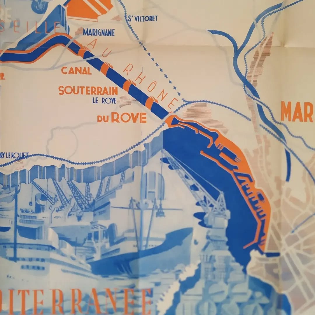
This vintage map, titled "The Port of Marseille and its Annexes," is an illustrated and schematic plan of the port facilities and communication routes around Marseille, dating from the 1950s. It highlights the importance of the industrial-port complex at the time. The map uses a blue, orange, and white color scheme, typical of Art Deco or post-war industrial designs. The illustration clearly and stylizes the canal network, including the Canal de Marseille au Rhône and the Canal Souterrain du Rove, as well as key areas such as Marignane Airport, the Lavera Oil Port, and the Port of Bouc. Illustrations of aircraft (likely vintage aircraft such as the Breguet 763 Deux-Ponts seen in one photo), cranes, and ships (with slightly blurred and impressionistic renderings for the water and sky) highlight the logistical and industrial activity. The style is both technical and artistic, aimed at promoting the region's infrastructure. The map measures 68 cm by 48 cm
Condition :
Very good condition Please note, my maps are old and are not always in perfect condition!
List of the main places represented: Lavera Oil Port, Port de Bouc, Mediterranean Sea, Gardanne, Les Milles, Saint-Victoret, Fos, Istres, DASSUEN, Saint-Mitre, La Couronne, Carry le Rouet


-

Secure payment
-

Careful shipping
-

No reproduction
-

Satisfied or refunded


-

“Hello, thank you for sending this, the cards are superb!”
Jean-Philippe
-
"They are very beautiful, just need to frame them! Thank you"
Baptiste
-
"Fast shipping and very good tracking."
Alice
-
"My husband loved the maps I gave him for Christmas!"
Solène
