


Daily Mail Aerial Map of the Western Front - ca. 1940
Daily Mail Aerial Map of the Western Front - ca. 1940
Couldn't load pickup availability
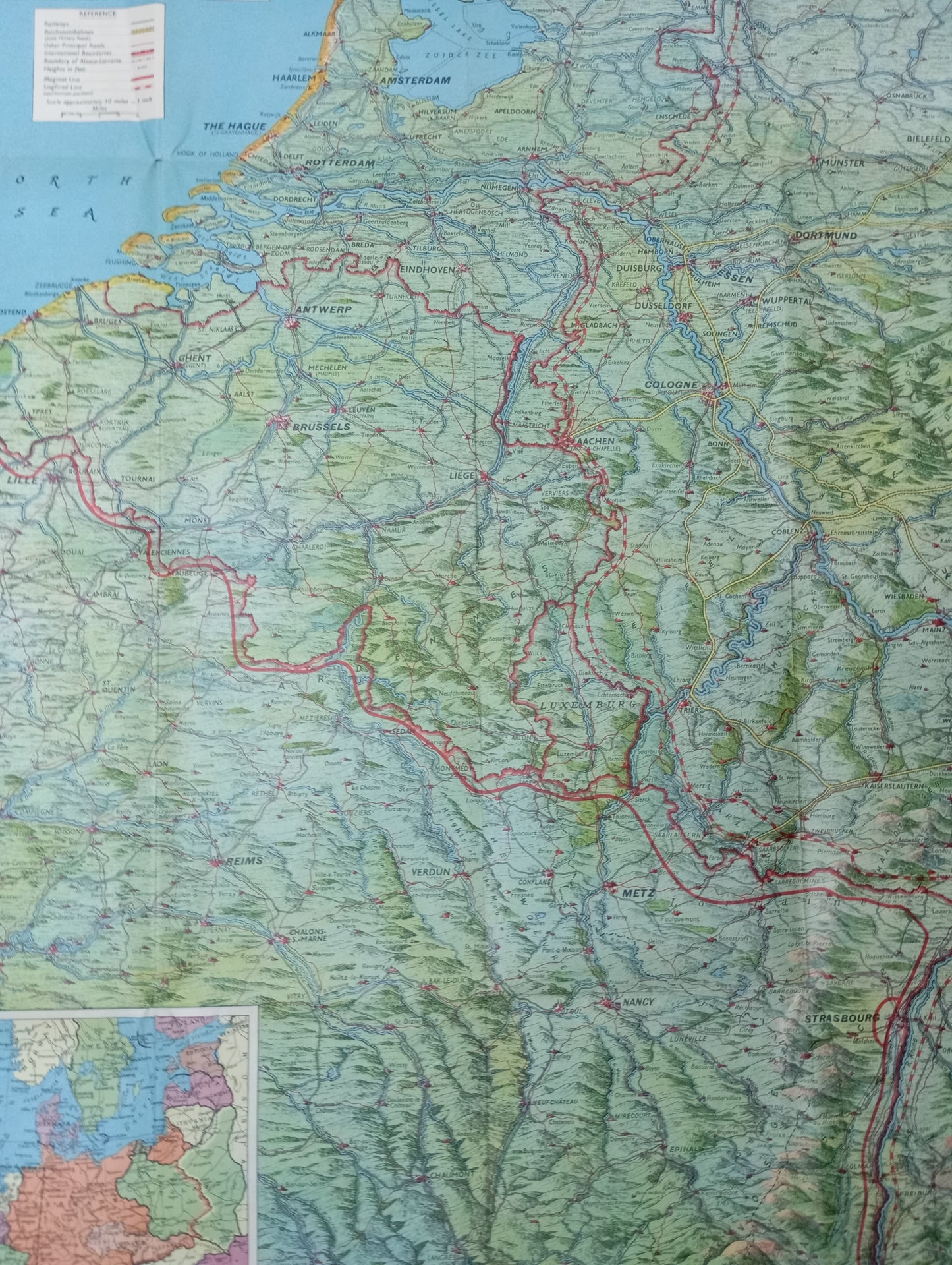
This aerial map of the Western Front, published by the Daily Mail, is a historical document that offers a detailed view of the northern regions of France, Belgium, and the Netherlands. Dated from the 1940s, it focuses on the strategic areas of the time. The map uses a distinct color palette with shades of green for relief and blue for bodies of water. The main front lines, roads, and railways are highlighted with red lines, illustrating communication routes and areas of conflict. A key and precise annotations are present to facilitate reading and understanding of geographical and military features. The city illustrations are stylized. The map measures 76 cm by 110 cm.
List of main places represented:
France, Belgium, Netherlands, Germany, North Sea, The Hague, Amsterdam, Rotterdam, Antwerp, Ghent, Brussels, Liège, Cologne, Luxembourg, Saarbrücken, Strasbourg, Nancy, Metz, Verdun, Reims, Lille, Dunkirk, Calais, Boulogne, Dieppe, Amiens, Rouen, Le Havre.
Condition:
Good condition, some folds have holes. Please note, my maps are old and not always in perfect condition!


-

Secure payment
-

Careful shipping
-

No reproduction
-

Satisfied or refunded


-

“Hello, thank you for sending this, the cards are superb!”
Jean-Philippe
-
"They are very beautiful, just need to frame them! Thank you"
Baptiste
-
"Fast shipping and very good tracking."
Alice
-
"My husband loved the maps I gave him for Christmas!"
Solène
