


Geographic and tourist map of France, "Route de l'Ouest" - ca. 1950
Geographic and tourist map of France, "Route de l'Ouest" - ca. 1950
Couldn't load pickup availability
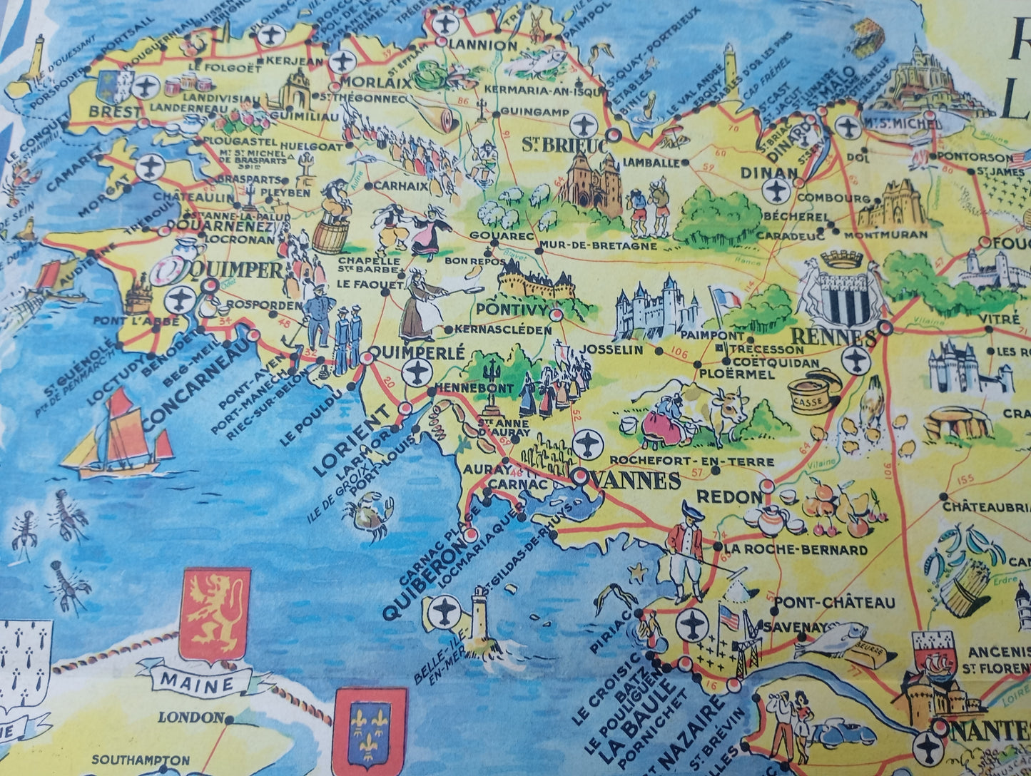
This wall map, titled "Route de l'Ouest," is a geographical and touristic work that covers western France, from Brittany to the Loire Valley. Published by Jacques Petit Angers, it is an invitation to travel. The map uses a pictorial approach, enriched with numerous illustrations of monuments, castles, scenes of local life, and regional symbols. It includes colorful representations of famous Loire Valley castles, Breton towns with their coats of arms, and even scenes of fishing and navigation. The map presents a road network and distances in kilometers to facilitate travel, making it both an informative and decorative guide. The map measures 31 cm by 44 cm.
Condition :
Good condition Please note, my maps are old and are not always in perfect condition!
List of main places represented:
Rennes, Vannes, Quimper, Brest, Saint-Brieuc, Saint-Malo, Nantes, Angers, Saumur, Tours, Cholet, Le Mans, Blois, Orléans, La Rochelle, Quiberon, Belle-Île-en-Mer, Carnac, Locmariaquer, Piriac, Le Croisic, Batz, La Baule, Pornichet, Saint-Nazaire, Fougères, Vitré, Dinan, Dinard, Quimperlé, Lorient, Concarneau, Pontivy, Quiberon, Vannes, Mont-Saint-Michel, Chambord, Villandry, Chenonceau, Amboise, Blois.


-

Secure payment
-

Careful shipping
-

No reproduction
-

Satisfied or refunded


-

“Hello, thank you for sending this, the cards are superb!”
Jean-Philippe
-
"They are very beautiful, just need to frame them! Thank you"
Baptiste
-
"Fast shipping and very good tracking."
Alice
-
"My husband loved the maps I gave him for Christmas!"
Solène
