


Tourist map of the Pyrenees, circa 1930
Tourist map of the Pyrenees, circa 1930
Couldn't load pickup availability
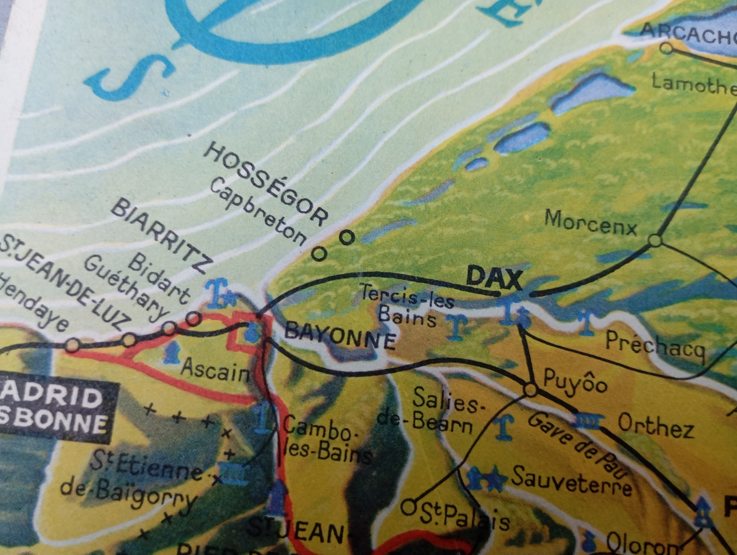
This vintage map illustrates the region from Auvergne to the Pyrenees. The relief is highlighted by a perspective effect that gives depth to the landscape, while the roads are clearly drawn in black and red, connecting the main towns. Illustrations of monuments and iconic tourist sites are scattered throughout the map. At the bottom left, a detailed key indicates points of interest, bridges, railways, and services of the time, including coach services. The map measures 42 cm by 22.5 cm.
Condition :
Good condition Please note, my maps are old and are not always in perfect condition!
List of main places represented:
Bordeaux, Dax, Bayonne, Biarritz, Pau, Toulouse, Carcassonne, Perpignan, Andorra, Arcachon, Paris, Nîmes, Montpellier, Narbonne, Castelnaudary, Albi, Cahors, Montauban, Castres, Foix, Pamiers, Gorges de l'Aude, Gorges de Pierrely.


-

Secure payment
-

Careful shipping
-

No reproduction
-

Satisfied or refunded


-

“Hello, thank you for sending this, the cards are superb!”
Jean-Philippe
-
"They are very beautiful, just need to frame them! Thank you"
Baptiste
-
"Fast shipping and very good tracking."
Alice
-
"My husband loved the maps I gave him for Christmas!"
Solène
