


Vintage Air France map, Super Constellation, ca. 1950
Vintage Air France map, Super Constellation, ca. 1950
Couldn't load pickup availability
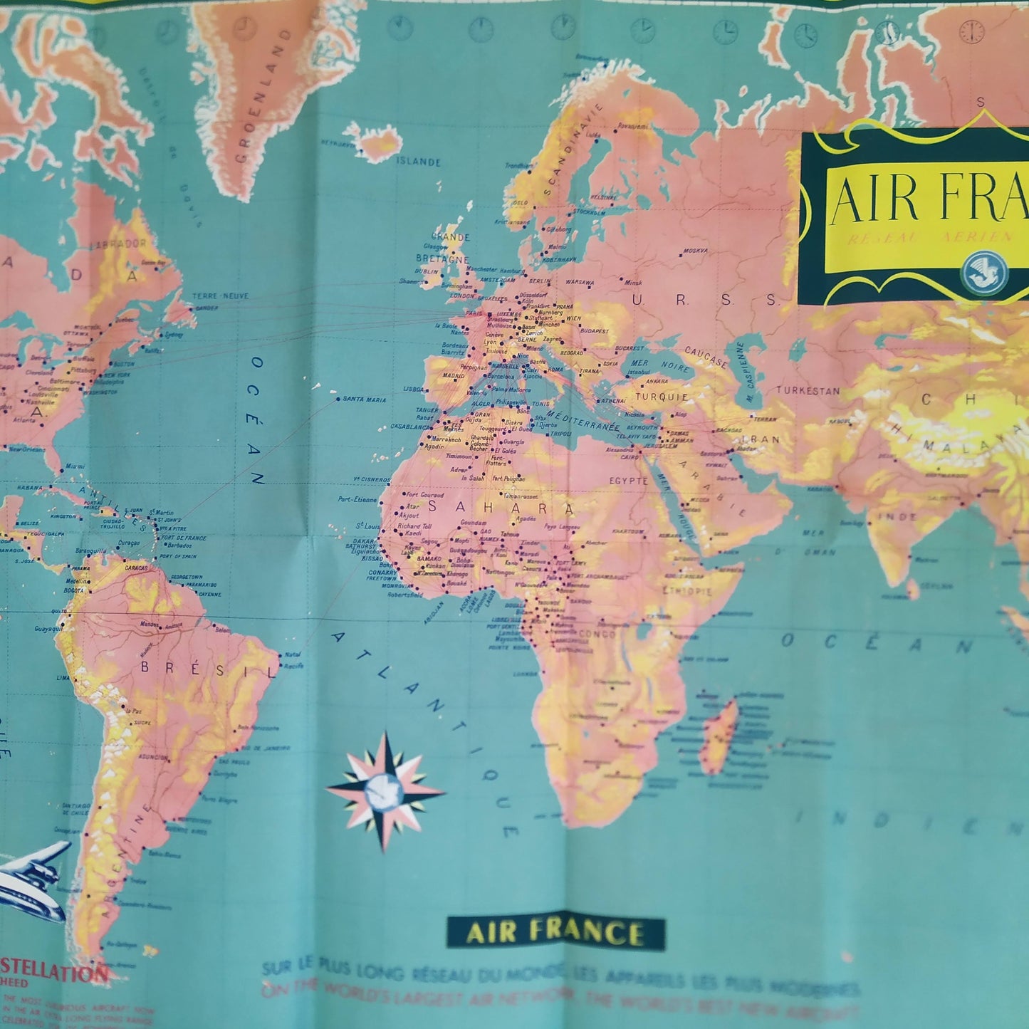
Vintage tourist map depicting the planisphere of Air France's worldwide airline network, dating from the 1950s. This graphic work is characteristic of post-war tourism advertising, highlighting the rise of intercontinental air travel. The slogan visible at the bottom of the map reads: "AIR FRANCE ON THE WORLD'S LONGEST NETWORK THE MOST MODERN AIRCRAFT" as well as the English version "ON THE WORLD'S LARGEST AIR NETWORK THE WORLD'S BEST NEW AIRCRAFT". The illustrated planisphere presents the route of Air France's airlines, connecting a large number of cities around the world. The company's fleet is highlighted with illustrations of two emblematic aircraft of the time: the "SUPER CONSTELLATION" and the "VICKERS VISCOUNT". The Super Constellation is notably described as "The most luxurious aircraft" with text highlighting its layout and speed. Yellow insets on either side of the map list the world's "MAIN AIR FRANCE AGENCIES." This style of cartography, although not signed on the map, is often associated with the work of the Ateliers Perceval and the famous "Monsieur Planisphère," Lucien Boucher, for Air France. Dimensions: 87 cm by 50 cm
Condition :
Very good condition Please note, my maps are old and are not always in perfect condition!
List of main places represented:
North America (New York, Montreal, Mexico), South America (Brazil, Argentina, Rio de Janeiro, Buenos Aires, Peru, Chile), Europe (Paris, London, Rome, Moscow, Scandinavia), Africa (Dakar, Cairo, Johannesburg, Tananarive, Sahara, Guinea, Congo), Asia (Beirut, Tehran, Calcutta, Tokyo, Hong Kong, India, Indochina), Australia, Atlantic Ocean, Pacific Ocean, Indian Ocean.


-

Secure payment
-

Careful shipping
-

No reproduction
-

Satisfied or refunded


-

“Hello, thank you for sending this, the cards are superb!”
Jean-Philippe
-
"They are very beautiful, just need to frame them! Thank you"
Baptiste
-
"Fast shipping and very good tracking."
Alice
-
"My husband loved the maps I gave him for Christmas!"
Solène
