


Vintage map of the Moon, visible and hidden sides - IGN - 1969
Vintage map of the Moon, visible and hidden sides - IGN - 1969
Couldn't load pickup availability
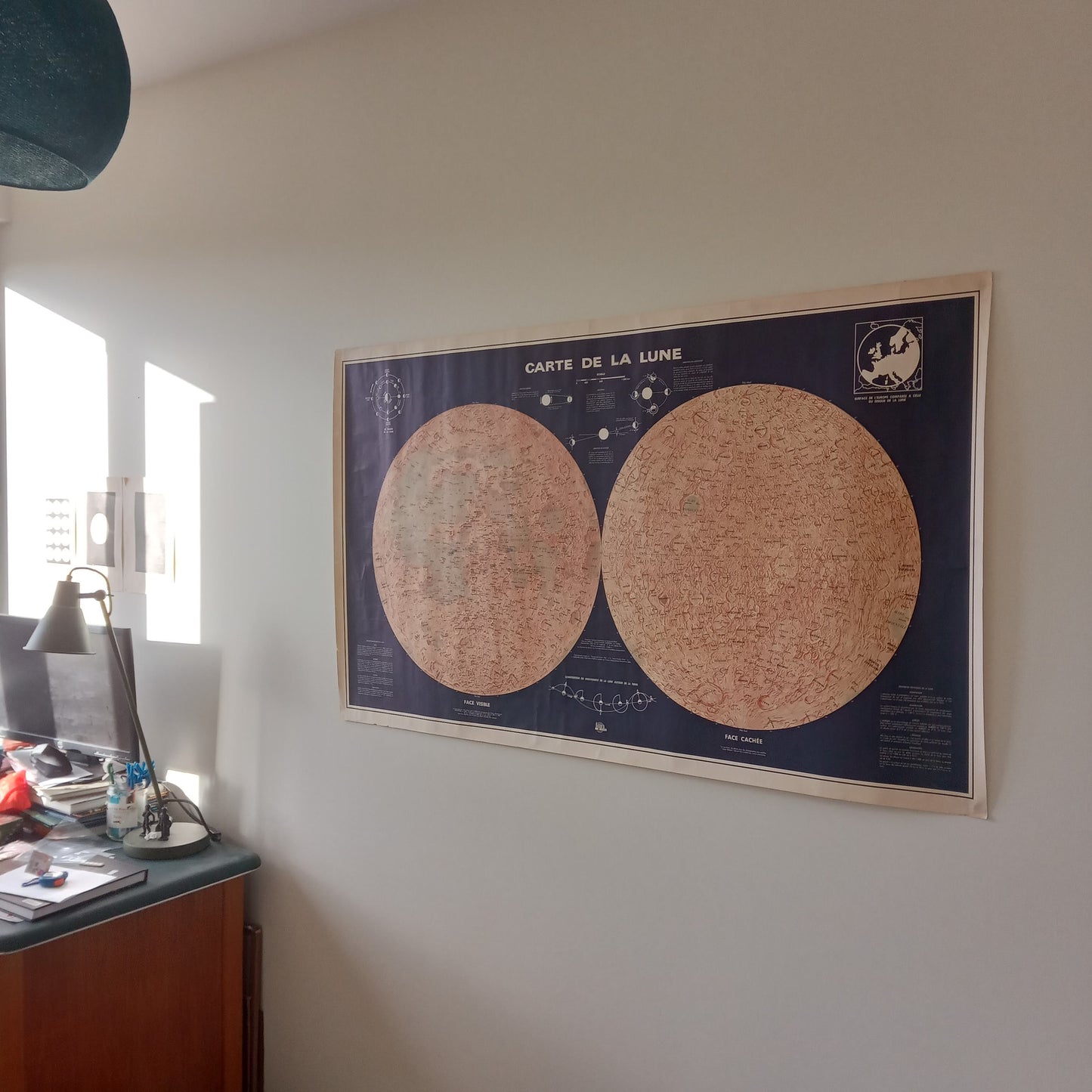
Vintage poster of the Moon, produced by the National Geographic Institute (IGN) around 1969. This large-format map shows the Near and Far Sides of our natural satellite. The cartography in shades of orange-brown on a navy blue background highlights the lunar reliefs, including the seas (Mares) and craters, with a detailed nomenclature in Latin. Informative inserts on the sides and in the center provide explanations of the phases of the Moon (Phases of the Moon), with diagrams illustrating the appearance of the Moon seen from Earth according to its position, the lunar libration (Libration in longitude and latitude), the scale and physical characteristics of the Moon (Scale, Dimensions, Mass, etc.), and the composition of the motion of the Moon around the Earth (Composition of the motion of the Moon around the Earth). The two lunar hemispheres are represented in a circular fashion, framed by a deep blue background. Orientation indications (North Pole, South Pole) are present on each side. The general style is very didactic and scientific, typical of IGN productions. The year 1969, marked by the first step of Man on the Moon (Apollo 11 Mission), gives this map a particular historical interest. The map measures 80 cm by 132 cm
Condition :
Good condition. Please note, my maps are old and not always in perfect condition! Shipped in a tube.
List of main places represented:
Mare Imbrium (Sea of Rains), Oceanus Procellarum (Ocean of Storms), Mare Serenitatis (Sea of Serenity), Mare Tranquillitatis (Sea of Tranquility), Mare Foecunditatis (Sea of Fertility), Mare Crisium (Sea of Crises), Mare Humorum (Sea of Humidity), Mare Cognitum (Known Sea), Sinus Iridum (Bay of Rainbows), Clavius, Copernicus, Ptolemaeus, Tycho, Kepler, Aristarchus, Plato.


-

Secure payment
-

Careful shipping
-

No reproduction
-

Satisfied or refunded


-

“Hello, thank you for sending this, the cards are superb!”
Jean-Philippe
-
"They are very beautiful, just need to frame them! Thank you"
Baptiste
-
"Fast shipping and very good tracking."
Alice
-
"My husband loved the maps I gave him for Christmas!"
Solène
