


Vintage tourist map of Northern France circa 1950
Vintage tourist map of Northern France circa 1950
Couldn't load pickup availability
Vintage tourist map of Northern France circa 1950
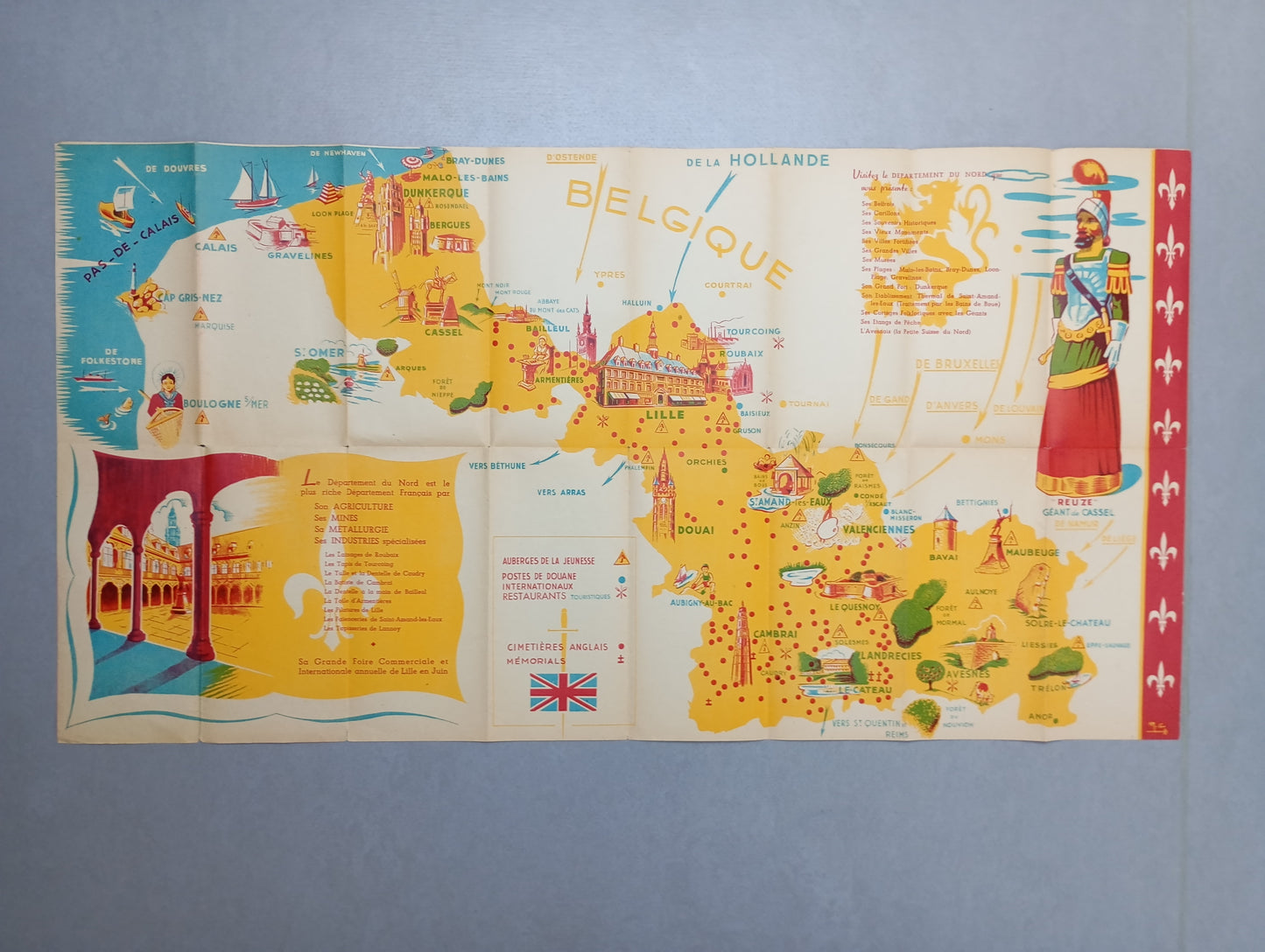
This map is a pictorial illustration of the Northern region of France, highlighting the main cities and tourist attractions of the time. It depicts the departments of Nord and Pas-de-Calais, as well as parts of Belgium and Holland. The map is richly illustrated with drawings of monuments, industrial symbols, leisure activities, and characteristic landscapes. It features beach scenes at Dunkirk, belfries, factories, beet fields, and even a "Giant" in soldier's uniform. Main roads and railways are indicated. The map is in an advertising or promotional style, probably intended to encourage local tourism. The dimensions are 84 cm by 44 cm.
List of main places represented:
Dunkirk, Loon Plage, Bray-Dunes, Malo-les-Bains, Bergues, Cassel, Hazebrouck, Armentières, Lille, Phalempin, Orchies, Douai, Aubigny-au-Bac, Roubaix, Tourcoing, Baisieux, Gruson, Saint-Amand-les-Eaux, Anzin, Valenciennes, Le Quesnoy, Avesnes-sur-Helpe, Bavay, Maubeuge, Arras, Boulogne-sur-Mer, Calais, Gravelines, Pas-de-Calais.
Condition :
Good condition, some light holes in some folds. Please note, my maps are old and not always in perfect condition!


-

Secure payment
-

Careful shipping
-

No reproduction
-

Satisfied or refunded


-

“Hello, thank you for sending this, the cards are superb!”
Jean-Philippe
-
"They are very beautiful, just need to frame them! Thank you"
Baptiste
-
"Fast shipping and very good tracking."
Alice
-
"My husband loved the maps I gave him for Christmas!"
Solène
