


Channel War Aerial Map - Daily Mail 1940
Channel War Aerial Map - Daily Mail 1940
Couldn't load pickup availability
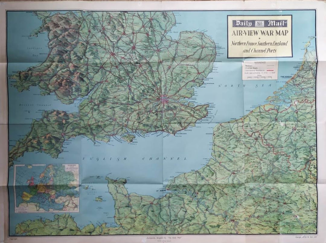
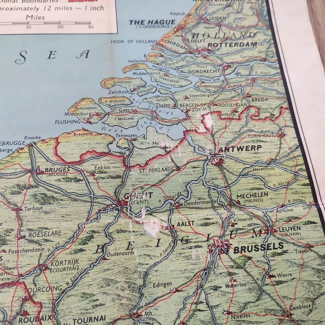
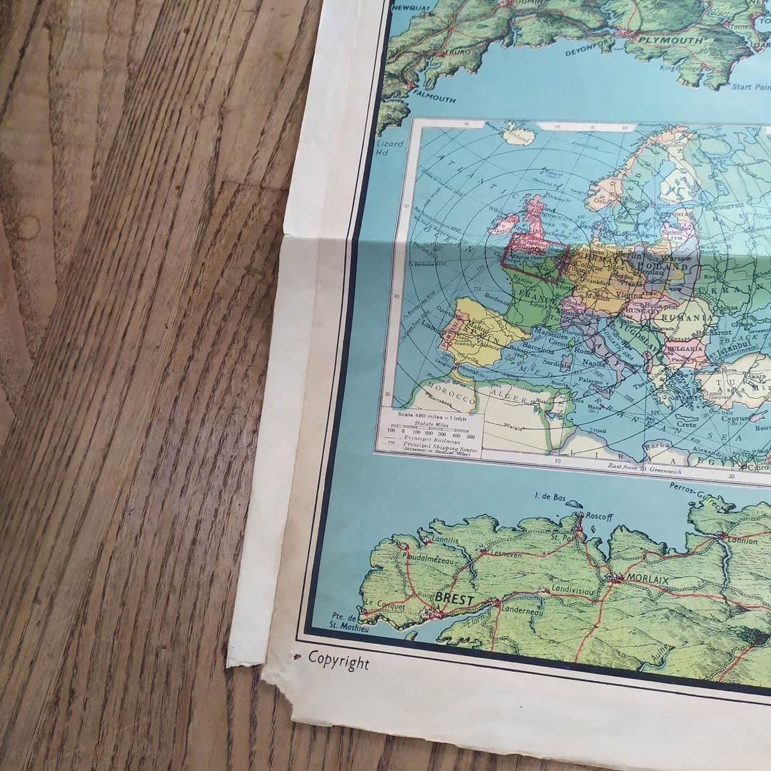
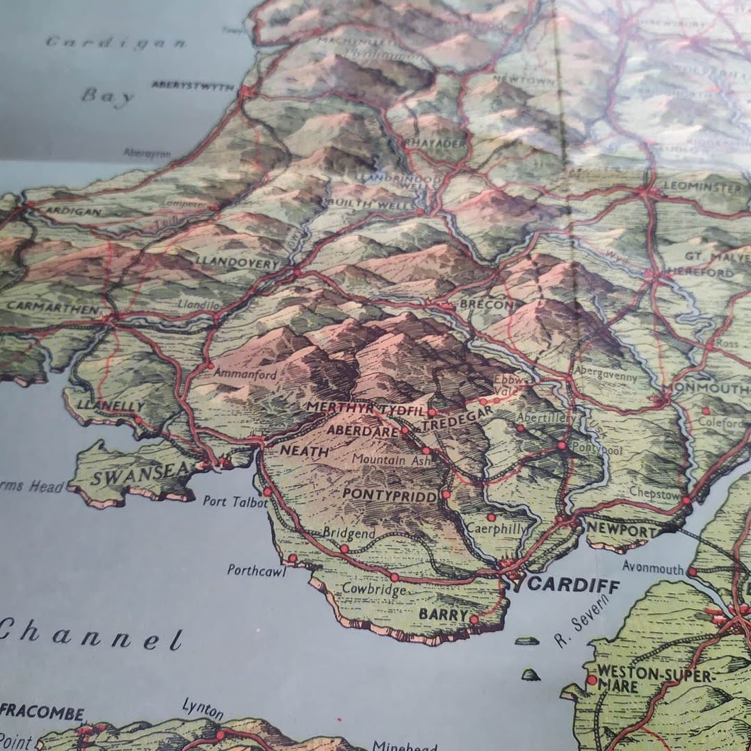
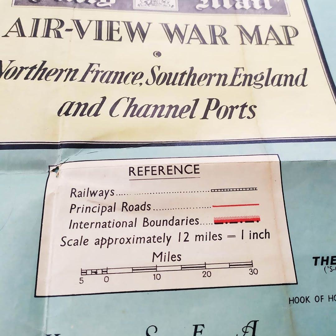
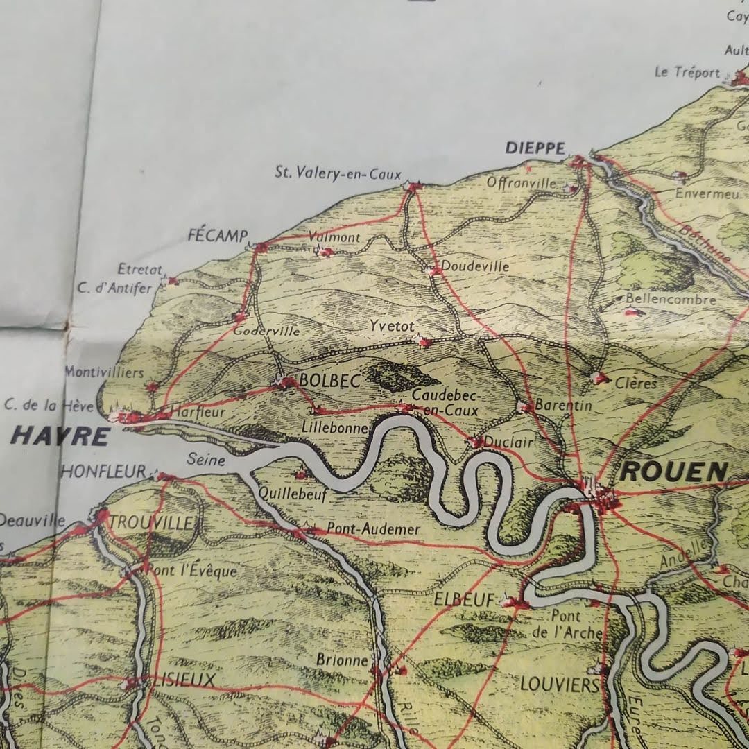
This aerial war map, published by the Daily Mail, offers a detailed view of the English Channel and surrounding areas, including northern France and southern England. Dated 1940, this large map (76*110 cm) was designed to provide a strategic perspective during the Second World War. It highlights Channel ports, communication routes, and coastal areas crucial to military operations. The colors used are primarily shades of green and blue, representing land and water respectively, with red lines marking roads and railways. A clear legend and precise annotations facilitate the understanding of the various mapped features. This map is a valuable historical tool, offering insight into strategic and geographical considerations during the war. 76*110 cm
Condition :
Good condition. Please note, my maps are old and not always in perfect condition!
Places :
England, France, London, Paris, English Channel, North Sea, War, Aerial Map, World War II, United Kingdom, Normandy, Brittany,

-

Secure payment
-

Careful shipping
-

No reproduction
-

Satisfied or refunded


-

“Hello, thank you for sending this, the cards are superb!”
Jean-Philippe
-
"They are very beautiful, just need to frame them! Thank you"
Baptiste
-
"Fast shipping and very good tracking."
Alice
-
"My husband loved the maps I gave him for Christmas!"
Solène
