


Illustrated and geographical map of the Isle of Yeu - 1938
Illustrated and geographical map of the Isle of Yeu - 1938
Couldn't load pickup availability
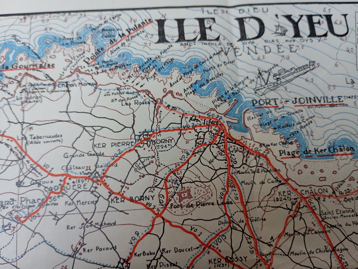
This map of the Île d'Yeu, signed by Georges Braine, is both an artistic and informative representation of the island. The map is detailed with the road network in red, contrasting with the fine lines of the coastal relief. It is enriched with black and white illustrations in the margins. These vignettes highlight typical aspects of the island, such as landscapes, marine animals, gastronomic specialties, and historical sites such as the "Vieux Château." The map includes a legend, a compass rose, and water depth indications, demonstrating its dual use as a tourist guide and geographical document. It measures 26.5 cm by 37.5 cm.
Condition :
Good condition Please note, my maps are old and are not always in perfect condition!
List of main places represented:
Port Joinville, Saint-Sauveur, La Meule, Ker Châlon, Ker Borni, The Old Castle, The Grand Phare.


-

Secure payment
-

Careful shipping
-

No reproduction
-

Satisfied or refunded


-

“Hello, thank you for sending this, the cards are superb!”
Jean-Philippe
-
"They are very beautiful, just need to frame them! Thank you"
Baptiste
-
"Fast shipping and very good tracking."
Alice
-
"My husband loved the maps I gave him for Christmas!"
Solène
