


Humorous Illustrated Map of Arizona – “Cartoon Map” by Reg Manning - 1939
Humorous Illustrated Map of Arizona – “Cartoon Map” by Reg Manning - 1939
Couldn't load pickup availability
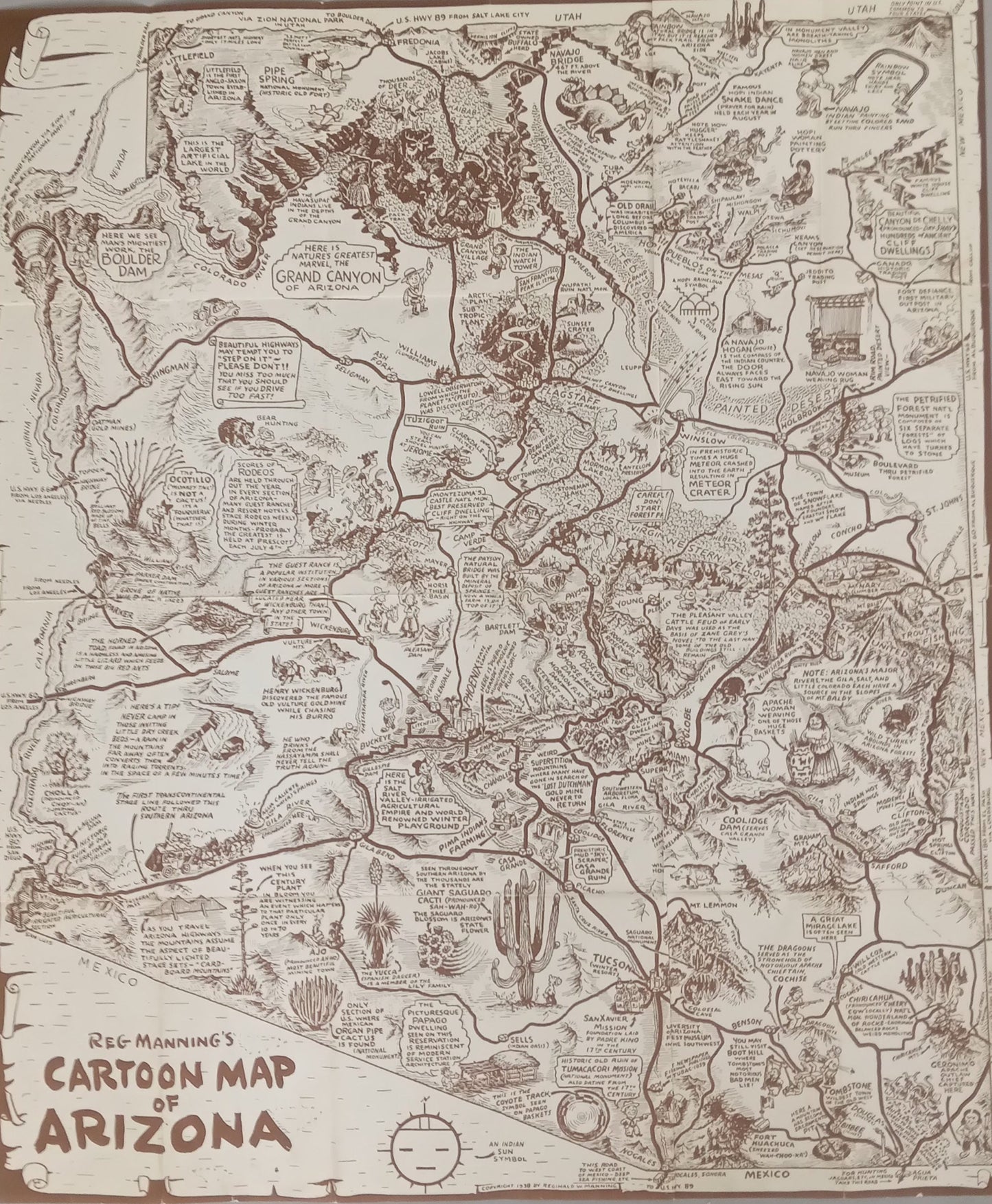
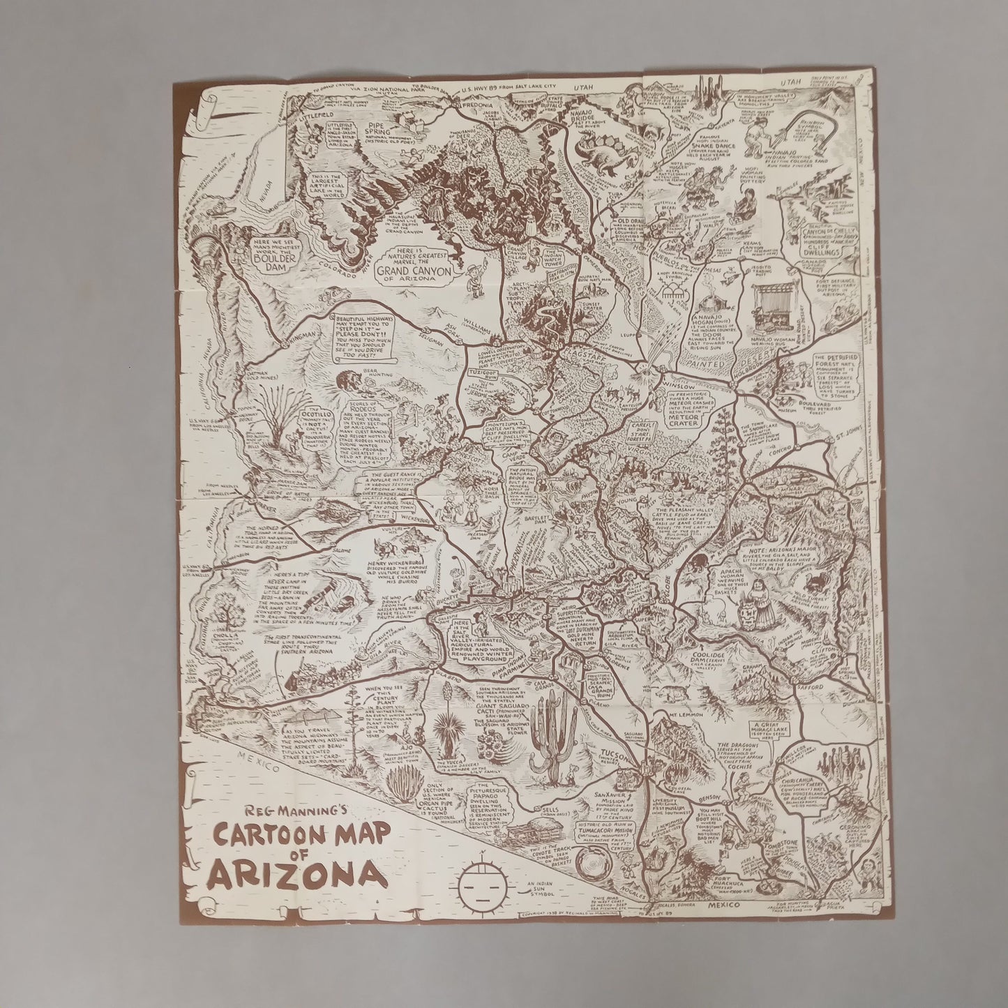
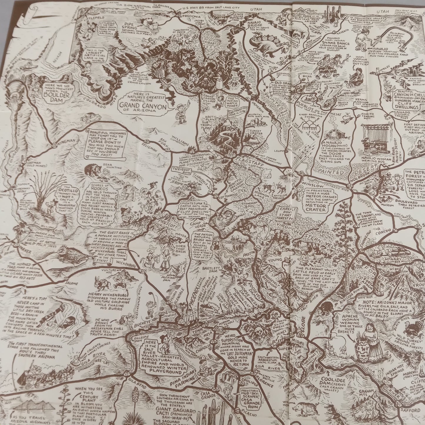
Rare and full of character, this vintage illustrated map of Arizona, created in 1939 by American cartoonist Reg Manning, is a must-have for lovers of antique and decorative maps. Measuring 48 x 41 cm, this Cartoon Map of Arizona blends humor, caricature, and geography in a style typical of the golden age of American illustration. Produced in brown monochrome, it represents Arizona through lively drawings, comical annotations, and local scenes, highlighting iconic landscapes (such as the Grand Canyon), wildlife, traditions, and the spirit of the American West. Each region of the state is sketched with an ironic wink, faithful to the artist's humorous tone. Reg Manning, a famous cartoonist and press illustrator, has made this map both informative and entertaining, highly sought after today by collectors of antique maps, enthusiasts of the American Southwest, or lovers of retro design.
Condition :
Very good condition. Please note, my maps are old and not always in perfect condition!
List of main places represented:
Arizona, United States, North America, Grand Canyon, Hoover Dam.


-

Secure payment
-

Careful shipping
-

No reproduction
-

Satisfied or refunded


-

“Hello, thank you for sending this, the cards are superb!”
Jean-Philippe
-
"They are very beautiful, just need to frame them! Thank you"
Baptiste
-
"Fast shipping and very good tracking."
Alice
-
"My husband loved the maps I gave him for Christmas!"
Solène
