


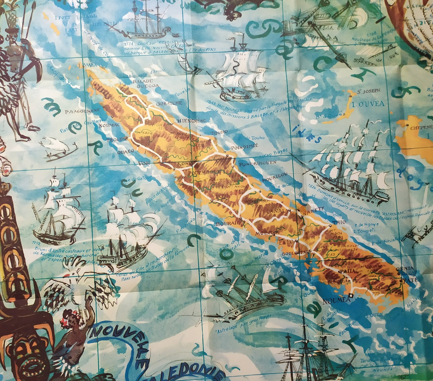
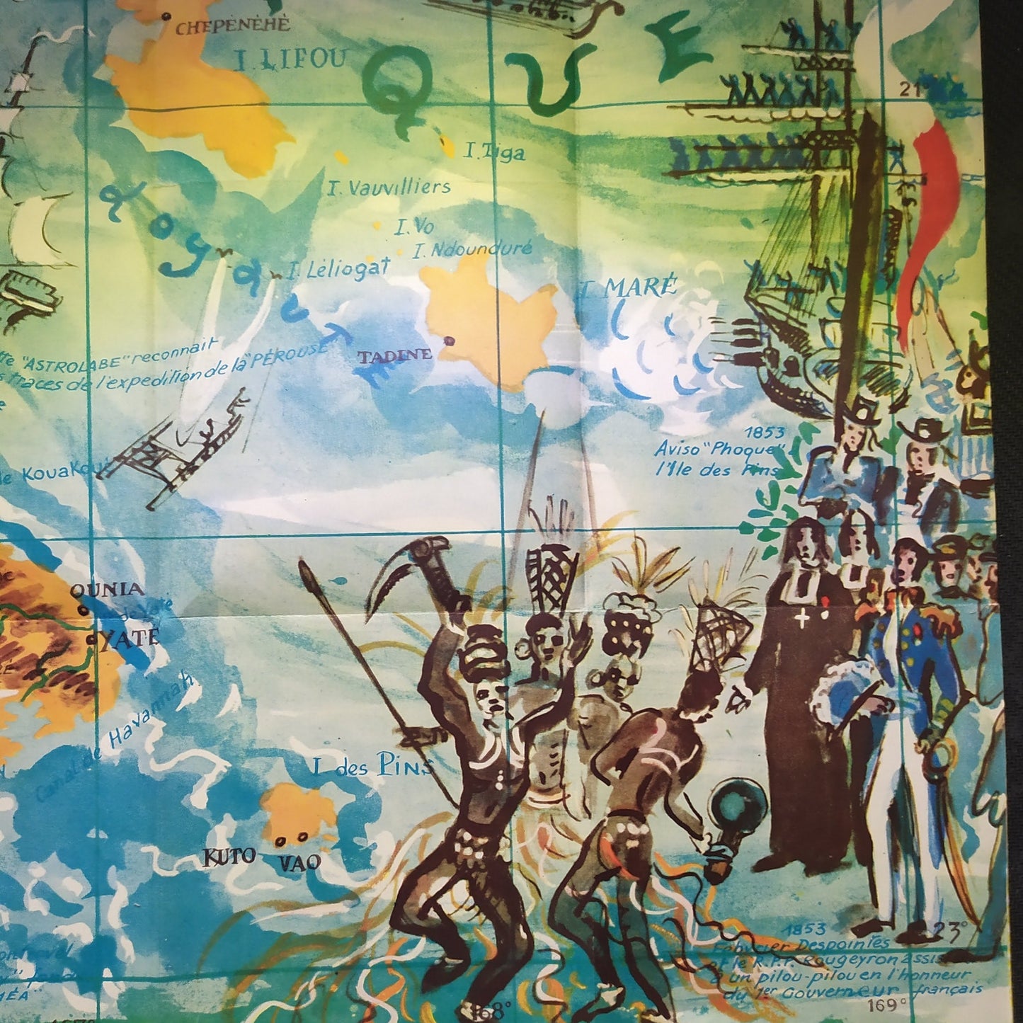
Illustrated map of New Caledonia from the 1950s by Monique Cras
Illustrated map of New Caledonia from the 1950s by Monique Cras
Couldn't load pickup availability
Discover this illustrated map of New Caledonia from the 1950s, created by Monique Cras. It offers a rich visual exploration of the island, highlighting its diverse landscapes, cultural traditions, and history. The map is adorned with colorful illustrations of ships, local figures, and cultural symbols, offering a fascinating insight into the region during this period. The annotations and artistic details make it a valuable tool for history and cartography enthusiasts. Dimensions: 62 x 42 cm.
Condition :
Very good condition. Please note, my maps are old and not always in perfect condition!
Places :
New Caledonia, Oceania, Pacific, Loyalty Islands, Grande Terre, Noumea, Kanaky, Melanesia, Polynesia, Micronesia, Australia, New Zealand, Papua New Guinea, Vanuatu, Fiji, Samoa, Tonga, Solomon Islands, Cook Islands, Marshall Islands, Palau, Nauru, Tuvalu, Kiribati, Wallis and Futuna, Niue, Tokelau, Pitcairn, Guam, Hawaii, Easter Island, Tahiti, Bora Bora, Moorea, Raiatea, Huahine, Rangiroa, Marquesas, Gambier, Austral Islands, Society Islands, Tuamotu.


-

Secure payment
-

Careful shipping
-

No reproduction
-

Satisfied or refunded


-

“Hello, thank you for sending this, the cards are superb!”
Jean-Philippe
-
"They are very beautiful, just need to frame them! Thank you"
Baptiste
-
"Fast shipping and very good tracking."
Alice
-
"My husband loved the maps I gave him for Christmas!"
Solène
