


Vintage illustrated map of New Zealand by A.D. Baldwin - 1961
Vintage illustrated map of New Zealand by A.D. Baldwin - 1961
Couldn't load pickup availability
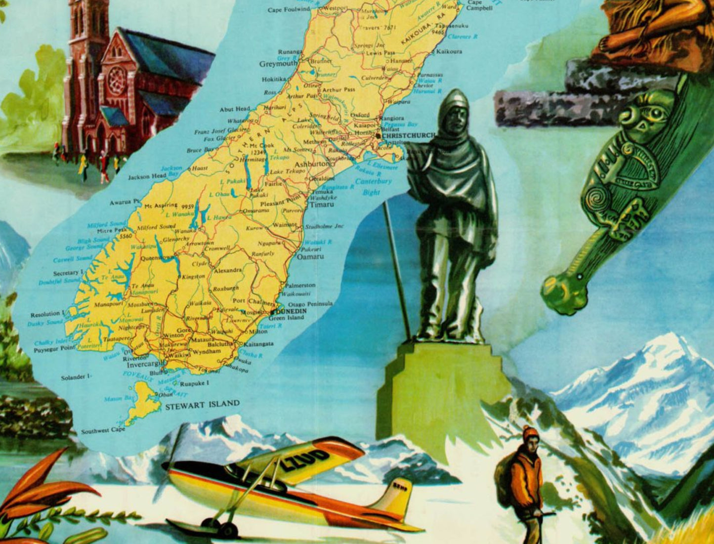
This colorful pictorial map, titled "UBD Pictorial Map - New Zealand Scenes," offers a vibrant, touristic vision of New Zealand in the early 1960s. At its center, a detailed geographical map of the country shows the main cities and regions of the North and South Islands. The map's border is richly decorated with diverse illustrations celebrating New Zealand culture and landscapes: skiers in action on snow-covered peaks, a canoe on a river, a native bird, and representations of Māori culture, including a carved figure and a woman in traditional dress. The composition also incorporates contemporary elements such as a small tourist plane and the Auckland Harbour Bridge. Published by A.D. Baldwin for Universal Business Directories Ltd., this work served as promotional material, as evidenced by the large white border intended for an advertising sticker. The map measures approximately 50 cm by 37 cm.
Condition :
Very good condition. Please note, my maps are vintage and not always in perfect condition! Shipped in a tube.
List of the main locations represented:
Auckland, Wellington, Christchurch, Dunedin, Hamilton, Rotorua, Napier, Nelson, Invercargill, Stewart Island, Bay of Plenty, Cook Strait, Mount Cook, Milford Sound.


-

Secure payment
-

Careful shipping
-

No reproduction
-

Satisfied or refunded


-

“Hello, thank you for sending this, the cards are superb!”
Jean-Philippe
-
"They are very beautiful, just need to frame them! Thank you"
Baptiste
-
"Fast shipping and very good tracking."
Alice
-
"My husband loved the maps I gave him for Christmas!"
Solène
