


Geographical and illustrated map of Italy by road, rail, sea and air - 1953
Geographical and illustrated map of Italy by road, rail, sea and air - 1953
Couldn't load pickup availability
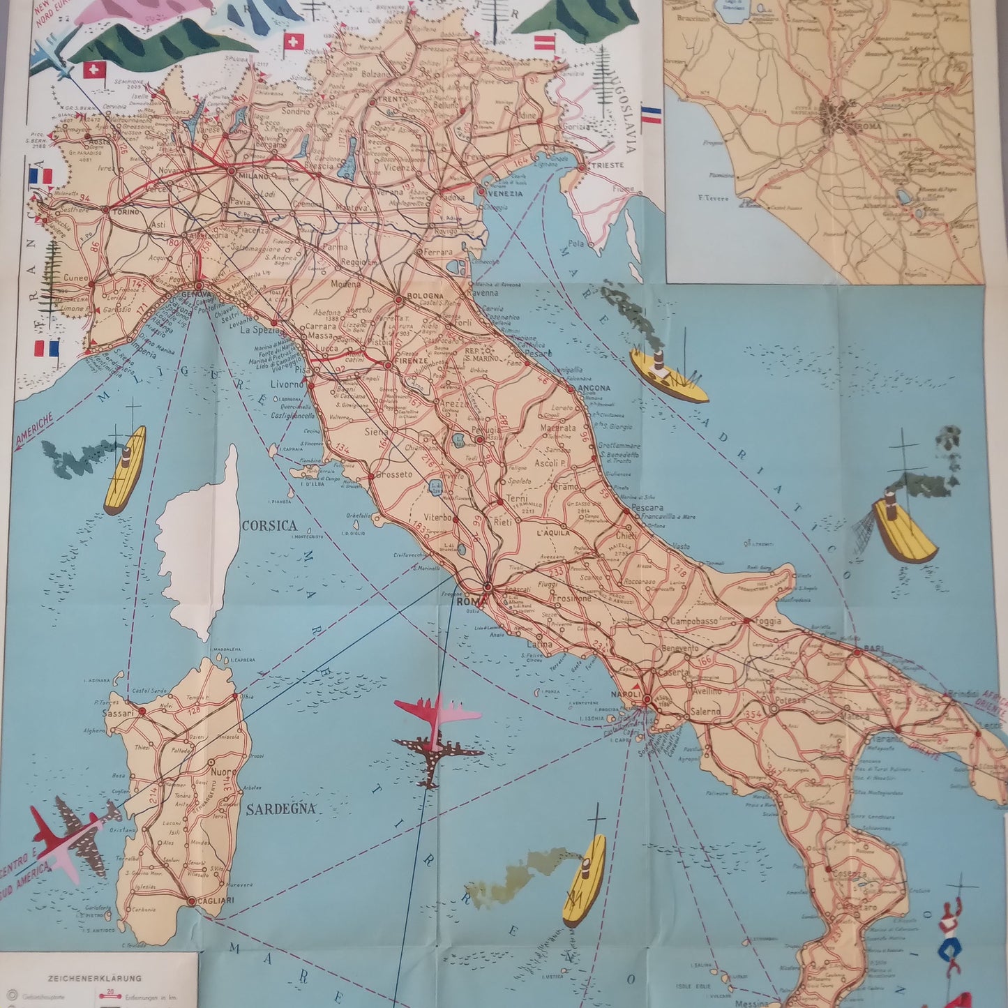
This vintage map of Italy, dated 1953, is an overview map of road, rail, sea, and air transport routes. It shows the Italian peninsula, Sicily, and Sardinia, highlighting transportation networks. Major roads and railways are outlined in red. What makes this map particularly attractive is its illustration of sea and air communication routes: small airplanes (pink and red) and yellow and red ships are drawn on the sea, marking the routes. The flags of neighboring countries (Switzerland, Austria, Yugoslavia, France) are also depicted at the top. A legend cartouche at the bottom left provides explanations of the symbols in German. An inset in the upper right corner shows a detailed plan of the Rome area. The whole is both informative and highly decorative, with a typical mid-20th-century illustration style. The map measures 80 cm by 58 cm.
Condition :
Good condition Please note, my maps are old and are not always in perfect condition!
List of main places represented:
Italy Sardinia Corsica Sicily Rome Naples Salerno Terni L'Aquila Pescara Foggia Campobasso Caserta Viterbo Grosseto Milan Venice Trieste Florence Bologna Palermo Cagliari


-

Secure payment
-

Careful shipping
-

No reproduction
-

Satisfied or refunded


-

“Hello, thank you for sending this, the cards are superb!”
Jean-Philippe
-
"They are very beautiful, just need to frame them! Thank you"
Baptiste
-
"Fast shipping and very good tracking."
Alice
-
"My husband loved the maps I gave him for Christmas!"
Solène
