


Illustrated map of Languedoc-Roussillon - ca. 1950
Illustrated map of Languedoc-Roussillon - ca. 1950
Couldn't load pickup availability
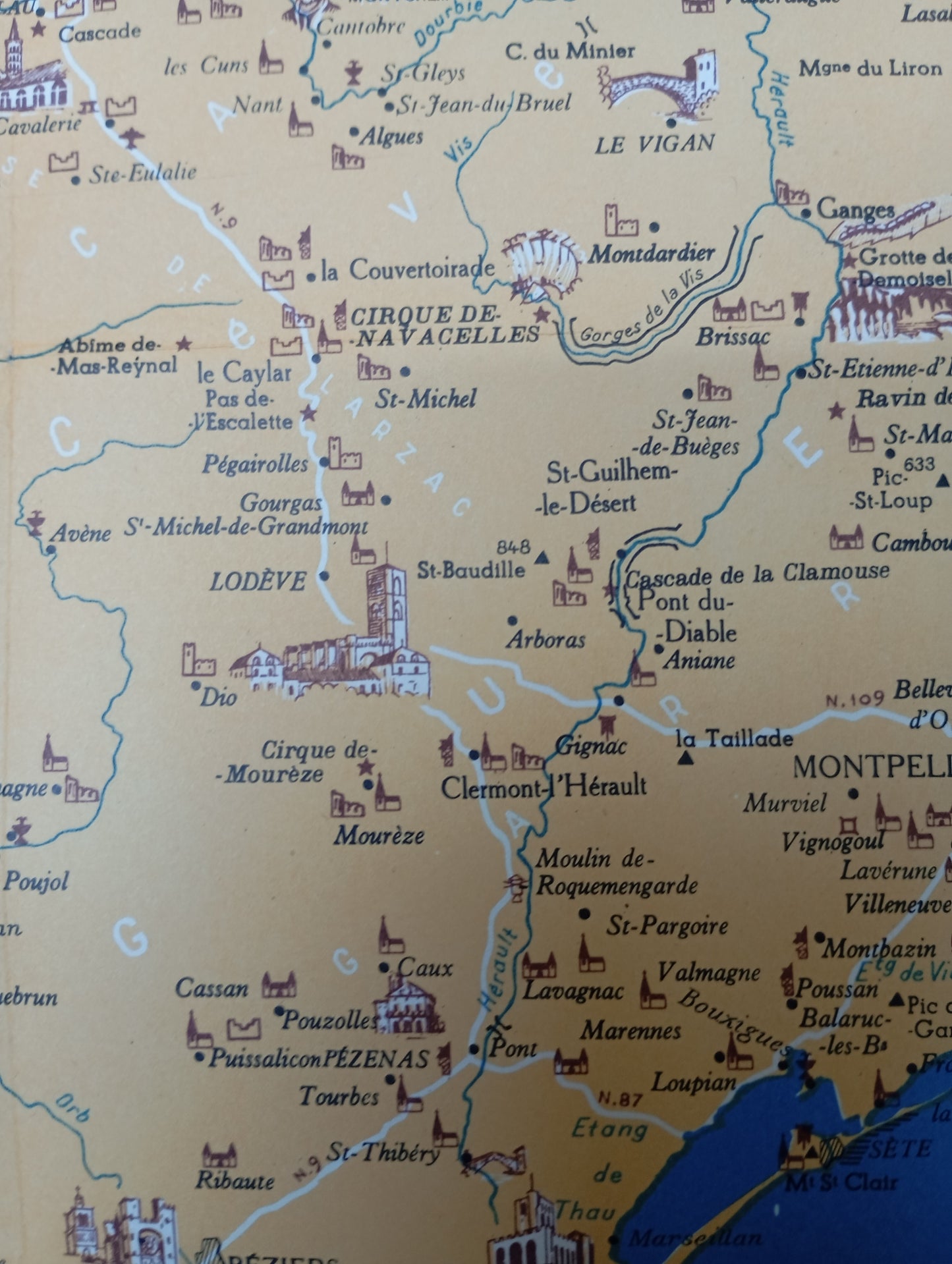
This map of Languedoc and Roussillon is surrounded by a decorative brown and turquoise border, adorned with starfish and graphic patterns. The map presents the region with an ochre yellow background and the Mediterranean in blue, topped by a stylized cartouche with the title "FRANCE MEDITERRANEAN LANGUEDOC-ROUSSILLON". Illustrations of monuments, castles, caves, and tourist sites are scattered throughout the map. The main rivers, the road network, and lakes are clearly indicated. The legend, located below the cartouche, explains the symbols of the places. The Pyrénées-Orientales with Perpignan, the Mediterranean coast, and the hinterland are well represented. The map measures 52 cm by 44 cm
State :
Good condition Please note, my cards are old and are not always in perfect condition!
List of main places represented:
Montpellier, Narbonne, Béziers, Perpignan, Sète, Agde, Nîmes, Lodève, Saint-Guilhem-le-Désert, Gorges of the Hérault, Cirque of Navacelles,


-

Secure payment
-

Careful shipping
-

No reproduction
-

Satisfied or refunded


-

“Hello, thank you for sending this, the cards are superb!”
Jean-Philippe
-
"They are very beautiful, just need to frame them! Thank you"
Baptiste
-
"Fast shipping and very good tracking."
Alice
-
"My husband loved the maps I gave him for Christmas!"
Solène
