


Retro map of the Pacific Ocean Line (New Caledonia) by CM Perrot - ca. 1950
Retro map of the Pacific Ocean Line (New Caledonia) by CM Perrot - ca. 1950
Couldn't load pickup availability
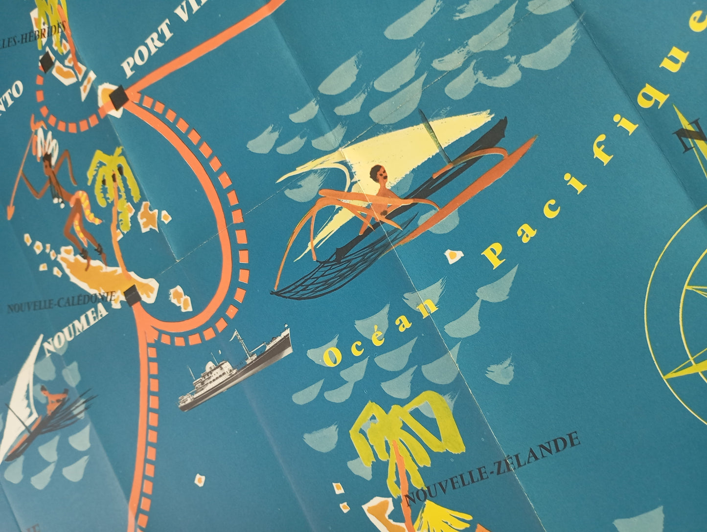
This illustrated map is an advertising poster for the Messageries Maritimes "Pacific Ocean Line." Created by artist C.M. Perrot, it highlights the shipping lines connecting Australia, New Zealand, and French Polynesia. The map features a colorful, painterly style typical of mid-20th-century travel posters, with illustrations of sailing ships and cruise ships plying the Pacific Ocean. Decorative motifs and figures of local people enrich the composition, capturing the exotic and adventurous spirit of maritime travel at the time. The map is both an informative and decorative piece. The map measures 76 cm by 56 cm.
Condition :
Very good condition Please note, my maps are old and are not always in perfect condition!
List of main places represented:
Australia, Sydney, New Caledonia, Noumea, New Hebrides, Espiritu Santo, Port Vila, Tahiti, Papeete, New Zealand


-

Secure payment
-

Careful shipping
-

No reproduction
-

Satisfied or refunded


-

“Hello, thank you for sending this, the cards are superb!”
Jean-Philippe
-
"They are very beautiful, just need to frame them! Thank you"
Baptiste
-
"Fast shipping and very good tracking."
Alice
-
"My husband loved the maps I gave him for Christmas!"
Solène
