


Panoramic map of Chicagoland by Homer Grooman - 1964
Panoramic map of Chicagoland by Homer Grooman - 1964
Couldn't load pickup availability
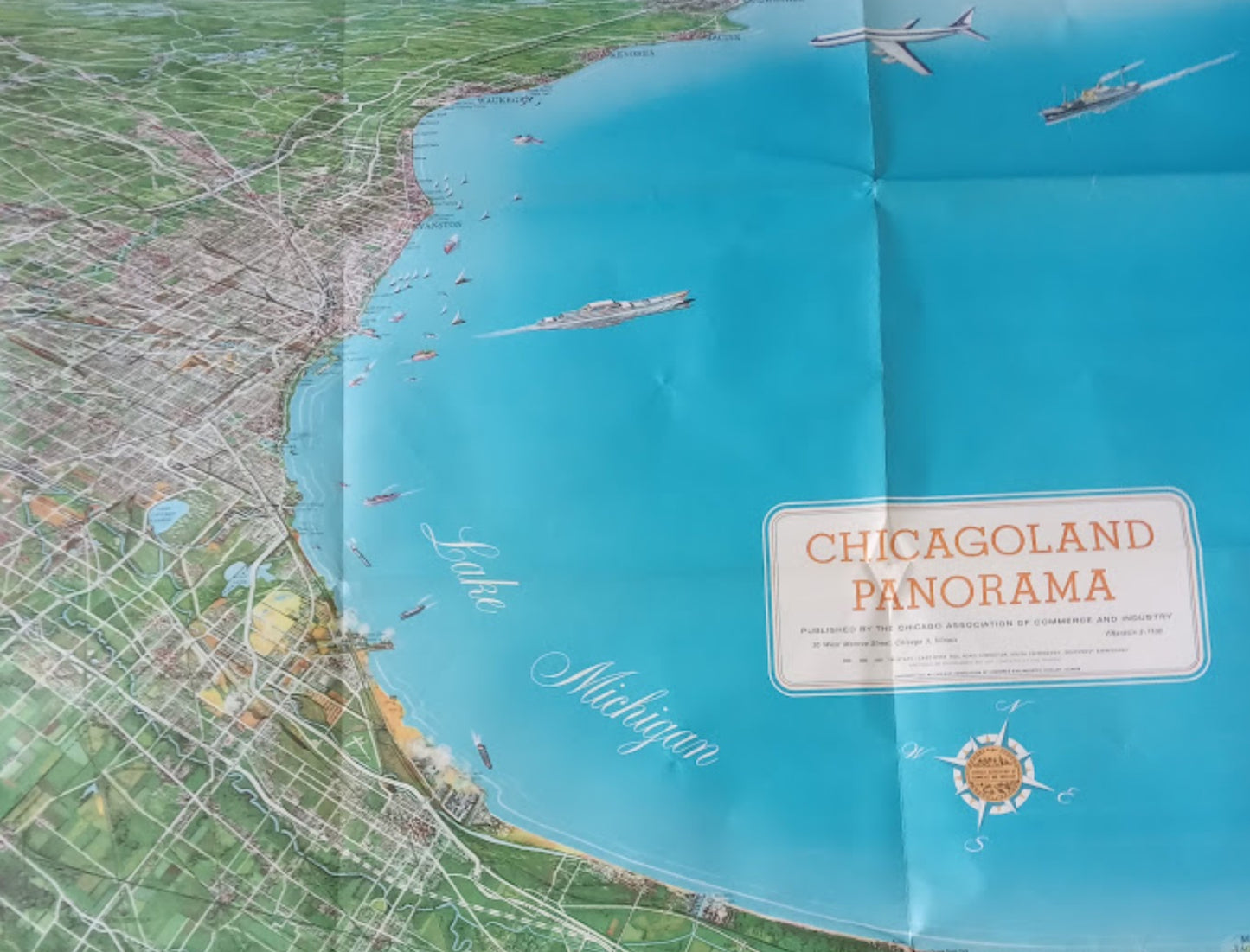
This impressive vintage poster offers a panoramic bird's-eye view of the Greater Chicago area as it appeared in the late 1950s. Created by illustrator Homer Grooman and published in 1964 by the Chicago Association of Commerce and Industry, this map extends well beyond the city limits to include places like Dubuque, Iowa, as well as Madison and Fond du Lac, Wisconsin. The illustration accurately depicts the network of cities, rivers, canals, and highways of the era. Iconic landmarks such as Soldier Field, the Museum of Science and Industry, the Great Lakes Naval Training Center, and the steel mills of Gary, Indiana, are clearly visible. The vast blue expanse of Lake Michigan dominates the right side of the image, enlivened by sailboats, merchant ships, and a passenger jet approaching one of the city's airports (Midway, O'Hare, or Meigs Field). An interesting historical note beneath the title specifies that the Tri-State East-West Corridor was planned but not yet completed at the time of printing. This work constitutes a valuable historical document for observing the urban development of the metropolis. The map measures 113 cm by 81 cm.
Condition :
Good condition. Please note, my maps are old and not always in perfect condition!
List of the main locations represented:
Chicago, Lake Michigan, Evanston, Waukegan, Kenosha, Racine, Gary (Indiana), Hammond, Soldier Field, Museum of Science and Industry, Wolf Lake, Lake Calumet Harbor, O'Hare Airport, Midway Airport.


-

Secure payment
-

Careful shipping
-

No reproduction
-

Satisfied or refunded


-

“Hello, thank you for sending this, the cards are superb!”
Jean-Philippe
-
"They are very beautiful, just need to frame them! Thank you"
Baptiste
-
"Fast shipping and very good tracking."
Alice
-
"My husband loved the maps I gave him for Christmas!"
Solène
