


Pictorial and tourist map of Alaska by The Alaska Line - ca. 1940
Pictorial and tourist map of Alaska by The Alaska Line - ca. 1940
Couldn't load pickup availability
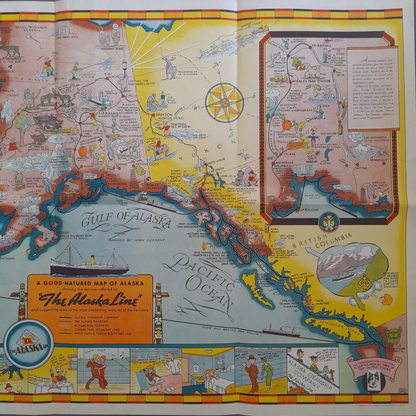
This vintage map, titled "A Good-Natured Map of Alaska," is a promotional publication for The Alaska Line (Alaska Steamship Company) dating from the 1940s. It is a pictorial and humorous map, richly illustrated with cartoonish drawings and scenes depicting life, wildlife, and activities in Alaska: gold prospectors, fishermen, iconic animals (bears, walruses, caribou), and active volcanoes. The tone is light and witty. A cartoon frieze frames the map, amusingly recounting the course of a cruise aboard a company ship. An insert introduces the services of The Alaska Line, and another details the Yukon region. It is a superb example of mid-20th-century American advertising cartography. The map measures 56 cm by 74 cm.
Condition :
Good condition Please note, my maps are old and are not always in perfect condition!
List of main places represented:
Alaska, British Columbia, Yukon, Gulf of Alaska, Pacific Ocean, Bering Sea, Alaska Peninsula, Aleutian Islands, Anchorage, Fairbanks, Juneau, Skagway, Nome.


-

Secure payment
-

Careful shipping
-

No reproduction
-

Satisfied or refunded


-

“Hello, thank you for sending this, the cards are superb!”
Jean-Philippe
-
"They are very beautiful, just need to frame them! Thank you"
Baptiste
-
"Fast shipping and very good tracking."
Alice
-
"My husband loved the maps I gave him for Christmas!"
Solène
