


Ancient pictorial map of Egypt, UAR - ca. 1950
Ancient pictorial map of Egypt, UAR - ca. 1950
Couldn't load pickup availability
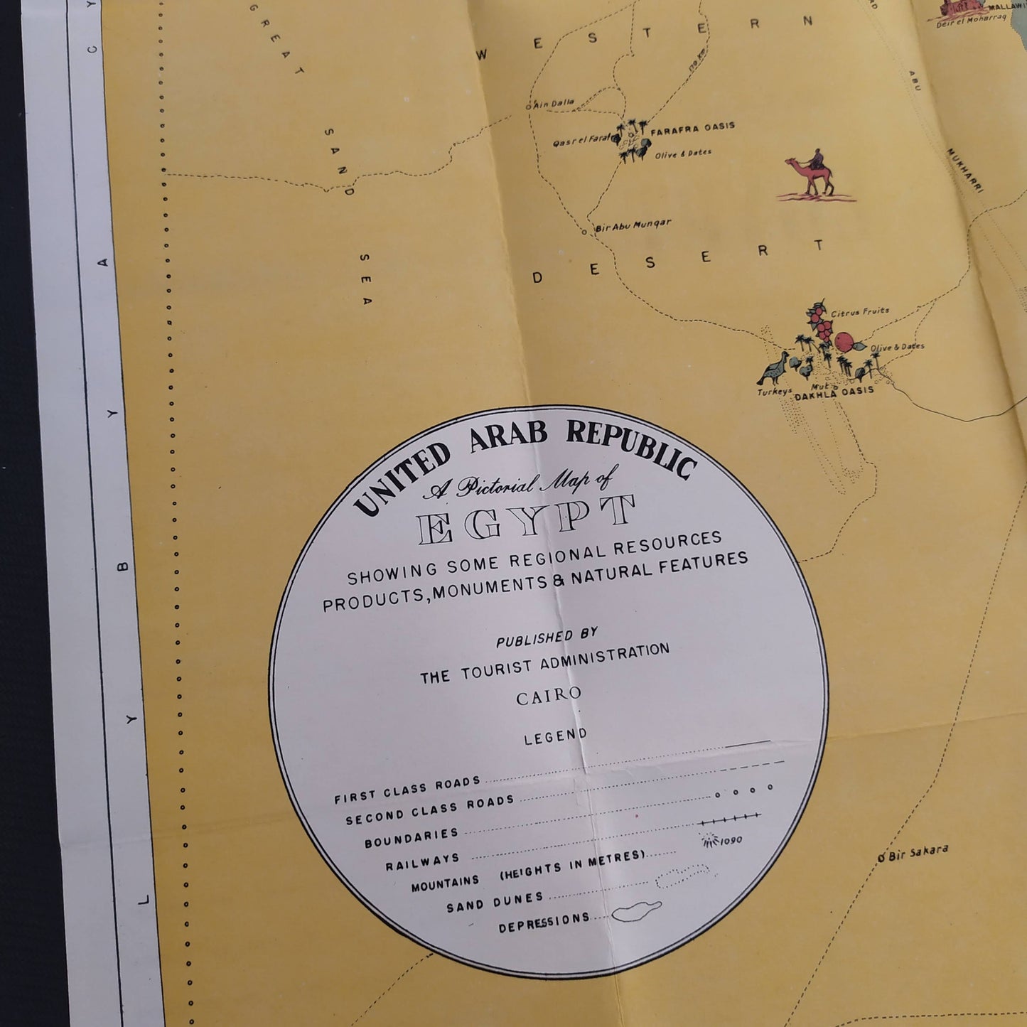
An old-style illustrated tourist and geographical map of Egypt published by "THE TOURIST ADMINISTRATION" of Cairo, probably in the 1950s. The title mentions "UNITED ARAB REPUBLIC", which places the map between 1958 and 1971, although the general aesthetic leans towards an earlier date, hence the mention ca. 1950, covering the transitional period. The map is entitled "A Pictorial Map of EGYPT Showing Some Regional Resources, Products, Monuments & Natural Features". It is richly illustrated with small vignettes depicting the pyramids, ancient temples (Karnak, Luxor, Abu Simbel), oases (Kharga, Dakhla), camel caravans in the desert, as well as regional productions (cotton, dates, fishing) and industrial installations. The course of the Nile and its fertile valley contrast with the vast expanses of the Western and Eastern Deserts. The legend includes symbols for roads, railways, mountains, and depressions. Dimensions: 41 cm by 46 cm
Condition :
Very good condition Please note, my maps are old and are not always in perfect condition!
List of main places represented:
Mediterranean Sea, Red Sea, Nile, Nile Delta, Cairo, Alexandria, Giza, Luxor, Aswan, Western Desert, Eastern Desert, Suez, Port Said, Oases (Farafra, Kharga, Dakhla), Temples of Abu Simbel, Valley of the Kings, Karnak.


-

Secure payment
-

Careful shipping
-

No reproduction
-

Satisfied or refunded


-

“Hello, thank you for sending this, the cards are superb!”
Jean-Philippe
-
"They are very beautiful, just need to frame them! Thank you"
Baptiste
-
"Fast shipping and very good tracking."
Alice
-
"My husband loved the maps I gave him for Christmas!"
Solène
