


Pictorial map of France by Lucien Boucher - ca. 1950
Pictorial map of France by Lucien Boucher - ca. 1950
Couldn't load pickup availability
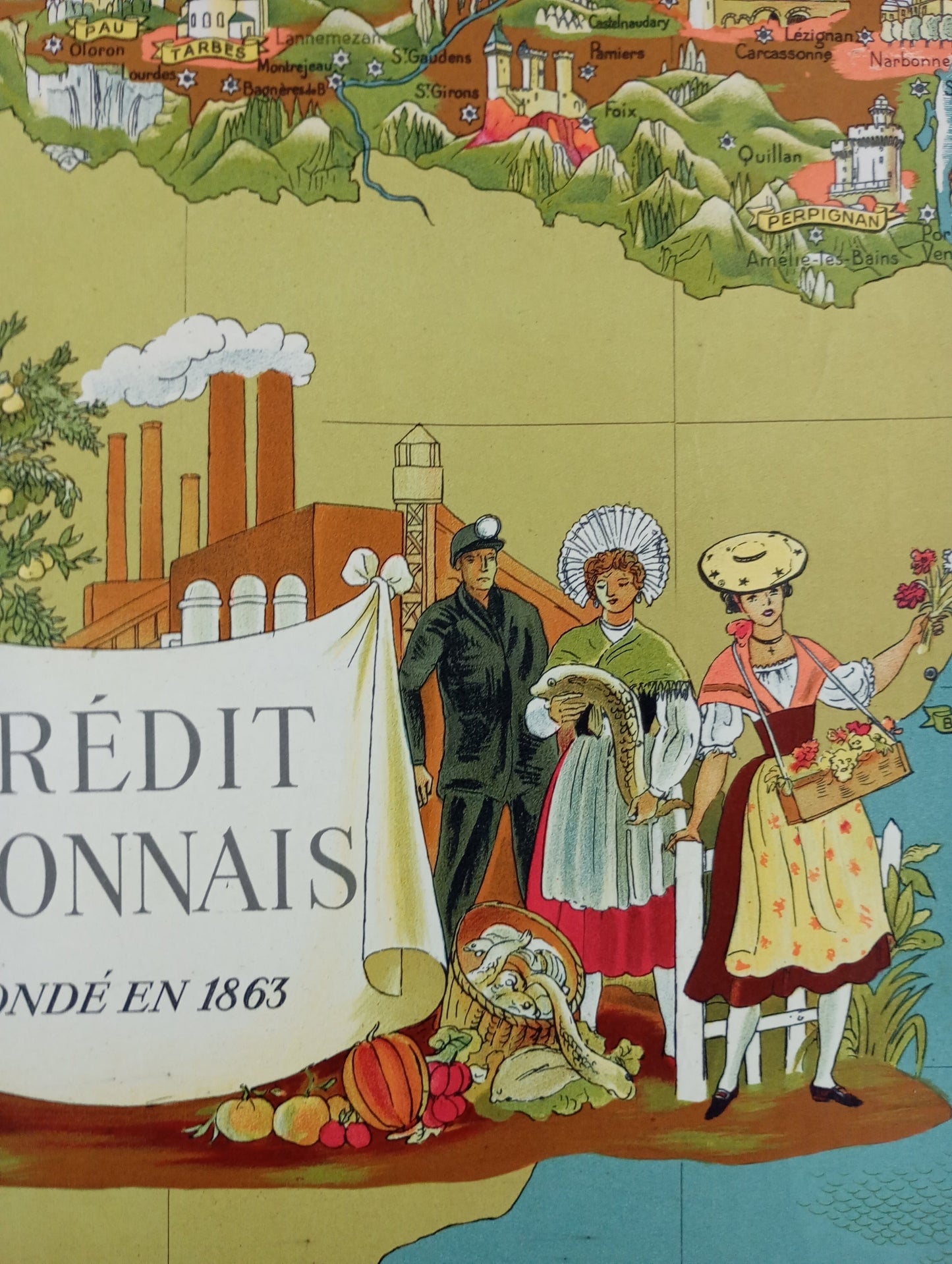
This wall map of France, designed by renowned artist and illustrator Lucien Boucher and published by Perceval Paris, is a work of cartographic art. Lucien Boucher's inimitable style is recognizable with his illustrations of iconic monuments, landscapes, and scenes of daily life. France is depicted as a land rich in culture, industry, and agriculture, with figures in traditional costume, castles, and famous cities. There are also maritime illustrations with boats, fish, and sea creatures. The design of this map, both informative and decorative, is characteristic of the artist's style. The mention of Crédit Lyonnais at the bottom of the map suggests it may have been created for the bank, which was founded in 1863. The map measures 105 cm by 75 cm.
Condition :
Good condition. Please note, my maps are old and not always in perfect condition! Shipped in a tube!
List of main places represented:
Paris, London, Lille, Strasbourg, Dijon, Lyon, Grenoble, Marseille, Toulon, Nice, Ajaccio, Montpellier, Perpignan, Toulouse, Bordeaux, Nantes, Rennes, Brest, Bayonne, Biarritz, Angers, Rouen, Caen, Cherbourg, Metz, Monaco, Rome, Brussels, La Rochelle.


-

Secure payment
-

Careful shipping
-

No reproduction
-

Satisfied or refunded


-

“Hello, thank you for sending this, the cards are superb!”
Jean-Philippe
-
"They are very beautiful, just need to frame them! Thank you"
Baptiste
-
"Fast shipping and very good tracking."
Alice
-
"My husband loved the maps I gave him for Christmas!"
Solène
