


Pictorial map of Switzerland, by Otto M. Müller - 1939
Pictorial map of Switzerland, by Otto M. Müller - 1939
Couldn't load pickup availability
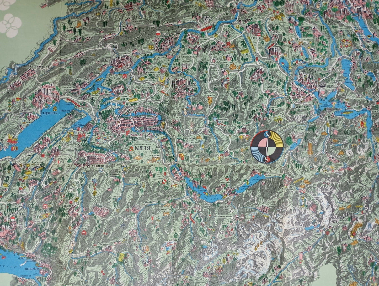
This large illustrated map of Switzerland, created by Otto M. Müller, a Swiss artist and graphic designer, is a detailed and rich pictorial work. Published by the Swiss National Tourist Office, it is a celebration of the country. The map is an overview of the Swiss territory, but instead of classic topography, it is filled with detailed and whimsical illustrations depicting cities, monuments, famous people, and landscapes. It includes accurate depictions of cities like Basel, Bern, and Geneva, with their iconic buildings, as well as scenes from daily life, legends, and tourist activities. Müller's style is characterized by careful attention to detail, the use of vibrant colors, and a narrative charm, making this map both informative and decorative. The map measures 116 cm by 78 cm.
Condition :
Good condition Please note, my maps are old and are not always in perfect condition!
List of main places represented:
Geneva, Basel, Bern, Fribourg, Zurich, Lausanne, Lucerne, Neuchâtel, Lugano, Montreux, Interlaken, Schaffhausen, Saint-Gall, Chur.


-

Secure payment
-

Careful shipping
-

No reproduction
-

Satisfied or refunded


-

“Hello, thank you for sending this, the cards are superb!”
Jean-Philippe
-
"They are very beautiful, just need to frame them! Thank you"
Baptiste
-
"Fast shipping and very good tracking."
Alice
-
"My husband loved the maps I gave him for Christmas!"
Solène
