


Pictorial and illustrated map of the history of France - 1934
Pictorial and illustrated map of the history of France - 1934
Couldn't load pickup availability
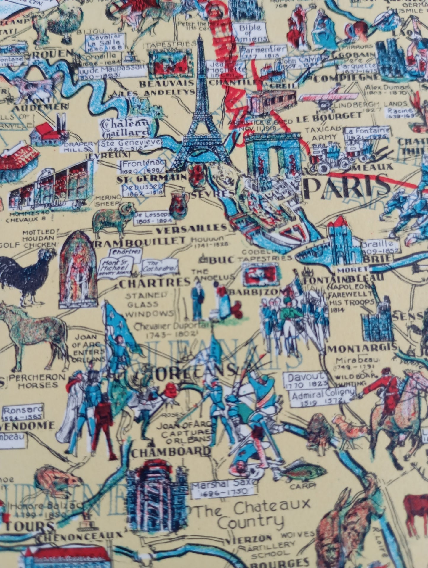
This illustrated, vintage map depicts the history and geography of France. Its title, "Story Map of France," highlights the country's key locations with detailed illustrations of historical figures, monuments, and significant events. It features battle scenes, figures of kings and queens, and symbols of French culture. The map's borders are adorned with decorative motifs and provincial coats of arms. The style is both educational and artistic, giving the map a unique vintage charm. This document is a collector's item that traces the history of France in an original and visual way. The map measures 43 cm by 34 cm.
Condition :
Good condition (presence of a small tear, see photo) Please note, my maps are old and are not always in perfect condition! Sent in a tube
List of main places represented:
Paris, Versailles, Chartres, Mont Saint-Michel, Loire Valley Castles (Chenonceaux, Chambord), Rouen, Le Havre, Normandy, Provence, Côte d'Azur, Pyrenees, Alps, Marseille.


-

Secure payment
-

Careful shipping
-

No reproduction
-

Satisfied or refunded


-

“Hello, thank you for sending this, the cards are superb!”
Jean-Philippe
-
"They are very beautiful, just need to frame them! Thank you"
Baptiste
-
"Fast shipping and very good tracking."
Alice
-
"My husband loved the maps I gave him for Christmas!"
Solène
