


Pictorial map of the 36th Infantry Division's campaigns in Italy - ca. 1940
Pictorial map of the 36th Infantry Division's campaigns in Italy - ca. 1940
Couldn't load pickup availability
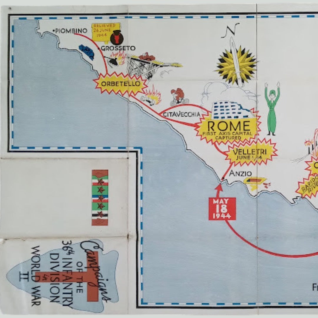
This pictorial map depicts the campaigns of the 36th US Infantry Division in Italy during World War II. It features a section of the Italian coastline with a red zigzag line indicating the progress of the fighting. The style is highly illustrated, with drawings of battles, soldiers, and explosions to mark key operational locations. Important cities such as Paestum, Salerno, Naples, Anzio, Rome, Grosseto, and Piombino are clearly marked. The map highlights crucial dates such as "SEPT 9, 1943 FIRST INVASION OF EUROPE" near Salerno and "MAY 18, 1944" at Anzio, as well as the capture of Rome, "FIRST AXIS CAPITAL CAPTURED." The vivid colors and cartoonish style contribute to the narrative and commemorative aspect of this historical piece. The division insignia is visible in the lower left corner, with the title "Campaigns of the 36th Infantry Division World War II." The map measures 41 cm by 68 cm.
Condition :
Average condition. Please note, my maps are old and are not always in perfect condition! The condition is average (presence of holes in the folds).
List of main places represented:
Italy Paestum Alta Villa Salerno Naples San Pietro Cassino Rapido River Anzio Velletri Rome Civitavecchia Orbetello Grosseto Piombino Mt. Castellone


-

Secure payment
-

Careful shipping
-

No reproduction
-

Satisfied or refunded


-

“Hello, thank you for sending this, the cards are superb!”
Jean-Philippe
-
"They are very beautiful, just need to frame them! Thank you"
Baptiste
-
"Fast shipping and very good tracking."
Alice
-
"My husband loved the maps I gave him for Christmas!"
Solène
