


Pictorial and geographical map of Macedonia - 1963
Pictorial and geographical map of Macedonia - 1963
Couldn't load pickup availability
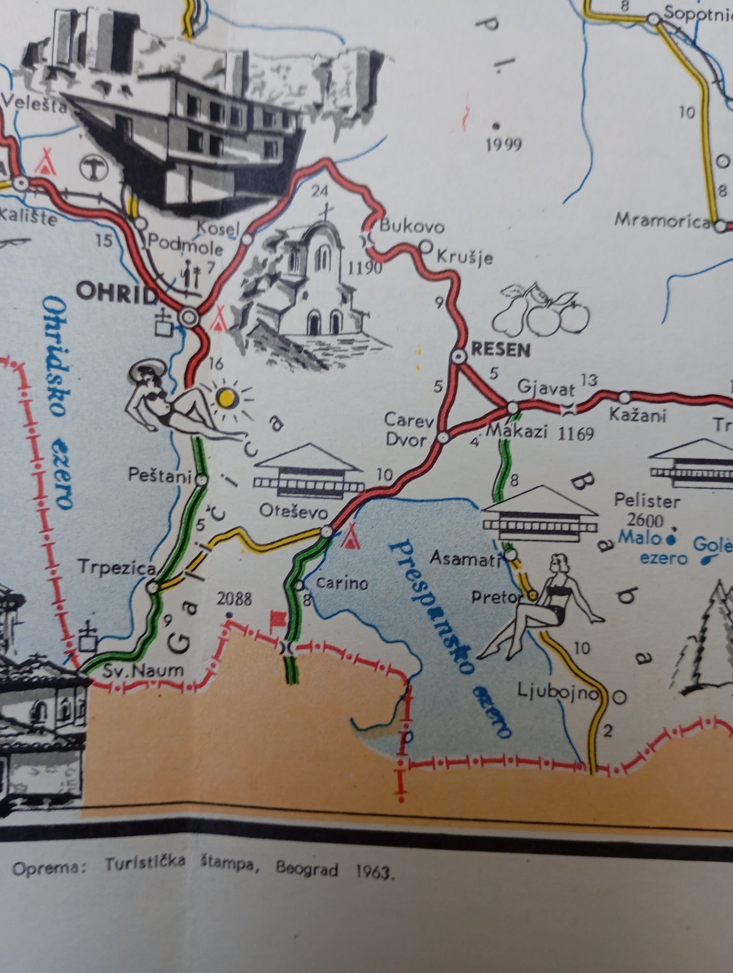
This map of Macedonia, then part of Yugoslavia, is a tourist and pictorial representation of the region. Published by Turistička štampa, Belgrade, in 1963, this document combines road mapping with detailed black and white illustrations of sites and monuments. The map features a multitude of sketches depicting Orthodox churches, monasteries, castles, lakes, and scenes of local life. The main roads are drawn with colored lines, while the illustrations attract the eye and inspire a desire to discover Macedonia's cultural and natural riches. The map is an example of cartographic work of the period, which aimed to both guide and promote tourism. It measures 42 cm by 50 cm.
Condition :
Good condition Please note, my maps are old and are not always in perfect condition!
List of main places represented:
Skopje, Ohrid, Tetovo, Gostivar, Kicevo, Bitola, Prilep, Stip, Radovis, Strumica, Kumanovo, Kocani.


-

Secure payment
-

Careful shipping
-

No reproduction
-

Satisfied or refunded


-

“Hello, thank you for sending this, the cards are superb!”
Jean-Philippe
-
"They are very beautiful, just need to frame them! Thank you"
Baptiste
-
"Fast shipping and very good tracking."
Alice
-
"My husband loved the maps I gave him for Christmas!"
Solène
