


Retro pictorial map of Franche-Comté and Jura - ca. 1950
Retro pictorial map of Franche-Comté and Jura - ca. 1950
Couldn't load pickup availability
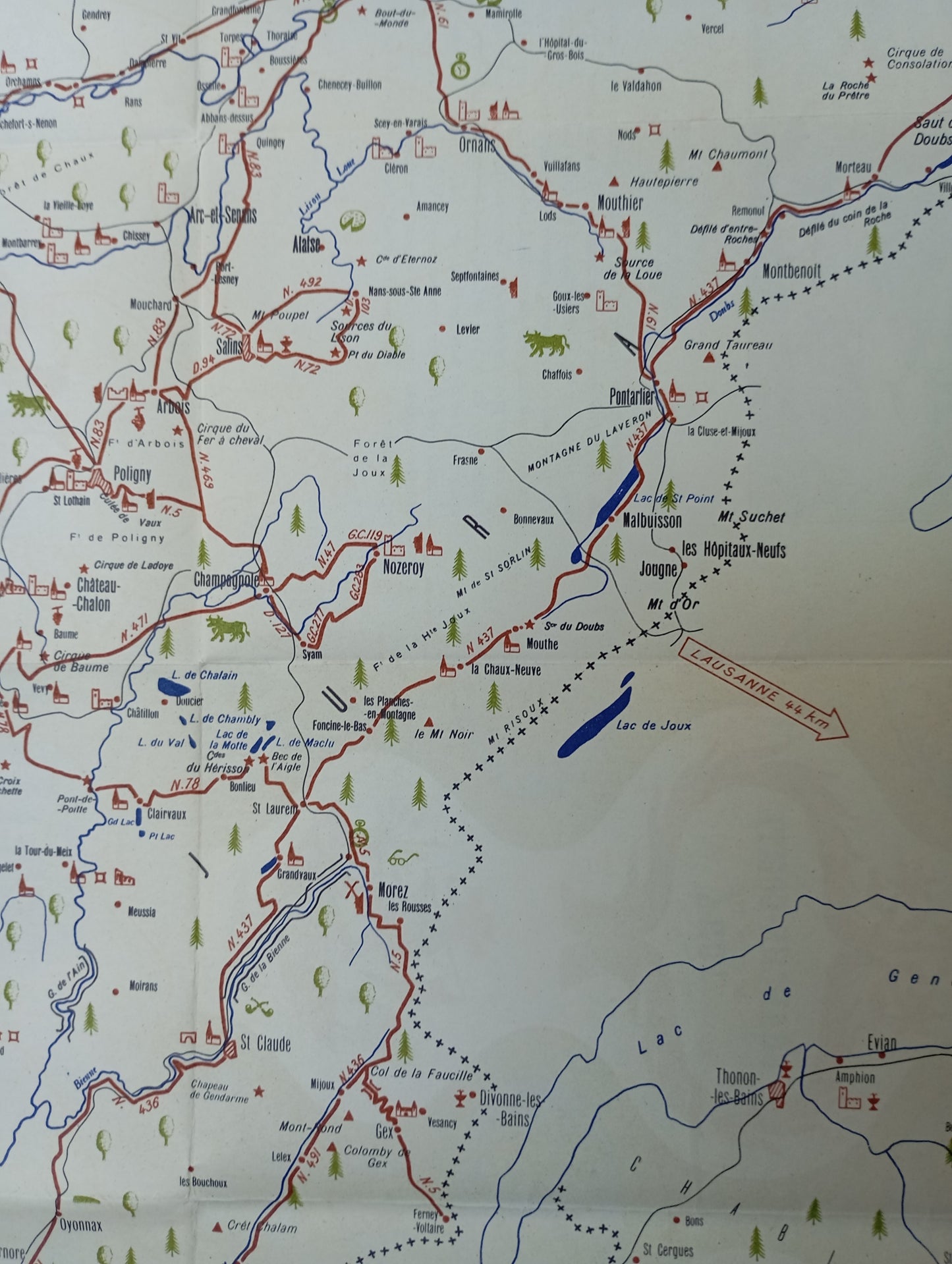
This illustrated map of Franche-Comté and Jura highlights the region's topography, with hills and forests represented by stylized drawings of trees. The map is bordered by a decorative green border with motifs of anchors and fir trees. In the upper left corner, a medieval-style cartouche displays the title "FRANCHE-COMTE ET LE JURA." The road network, rivers, and lakes are clearly marked. Illustrations of castles, churches, and typical houses are scattered throughout the map. A detailed key in the lower right corner explains the various symbols. The map measures 52 cm by 44 cm.
Condition :
Good condition Please note, my maps are old and are not always in perfect condition!
List of main places represented:
Besançon, Lons-le-Saunier, Pontarlier, Dole, Arbois, Poligny, Salins, Ornans, Montbéliard, Montmorot, Champagnole, Saint-Claude, Morez, Morteau, Lake Joux, Lake Saint-Point, Mont d'Or, Mont Suchet, Cirque de Baume, Cirque de Consolation


-

Secure payment
-

Careful shipping
-

No reproduction
-

Satisfied or refunded


-

“Hello, thank you for sending this, the cards are superb!”
Jean-Philippe
-
"They are very beautiful, just need to frame them! Thank you"
Baptiste
-
"Fast shipping and very good tracking."
Alice
-
"My husband loved the maps I gave him for Christmas!"
Solène
