


Retro pictorial map of Normandy - ca. 1950
Retro pictorial map of Normandy - ca. 1950
Couldn't load pickup availability
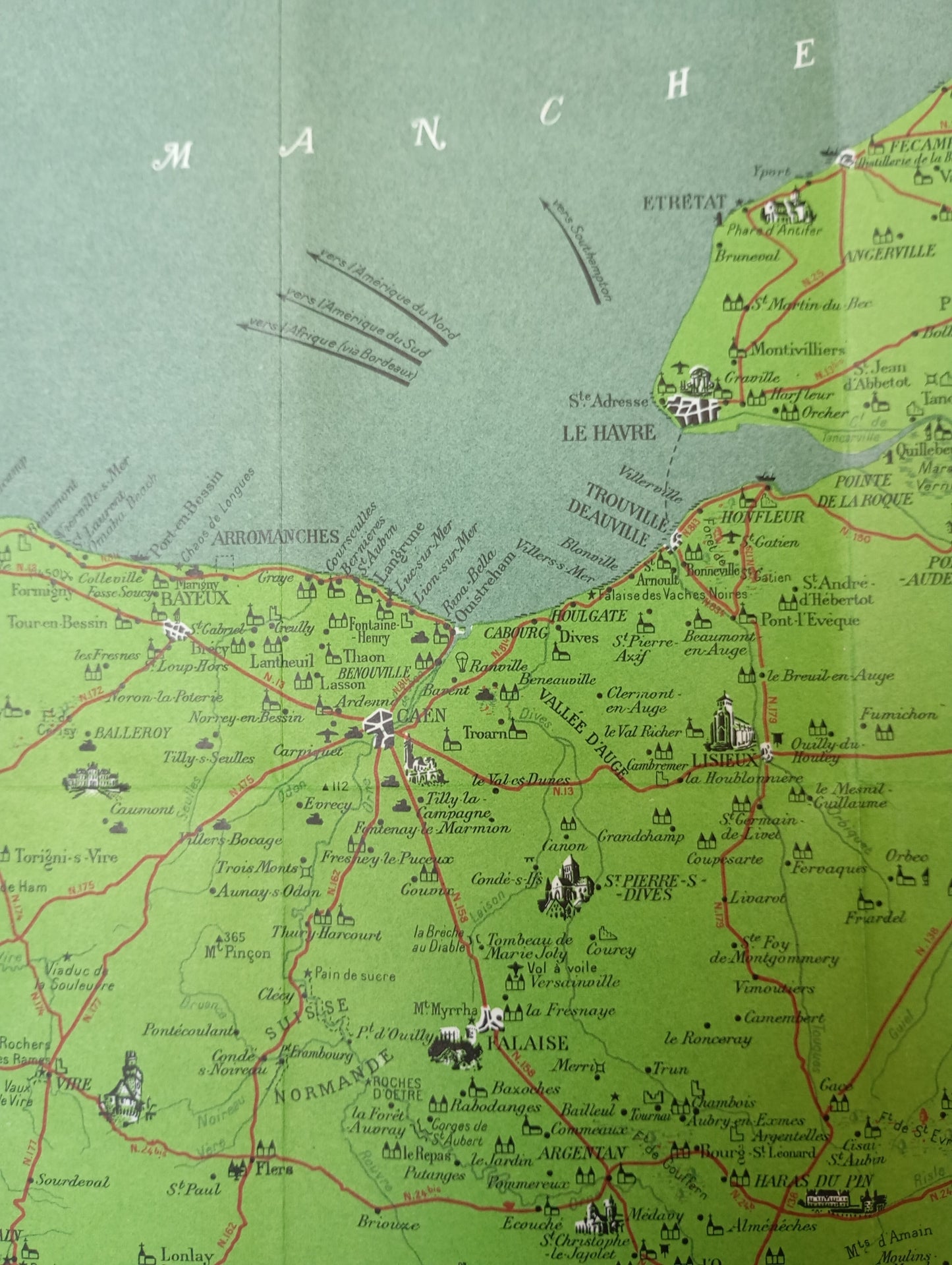
This pictorial map of Normandy is a charming and detailed representation of the region. It highlights roads and major towns. The map's decorative frame is adorned with animal motifs and stylized symbols in yellow and orange. A cartouche at the top of the map displays the title "NORMANDY" (key and explanations on the back in English). The map is richly illustrated with drawings of monuments, historic buildings, battle sites, and other points of interest, giving it a decorative yet informative appearance. The key located at the bottom right explains the meaning of the various symbols. On the back of the map, there are explanations of the places in English. The map measures 52 cm by 44 cm.
Condition :
Good condition Please note, my maps are old and are not always in perfect condition!
List of main places represented:
Le Havre, Rouen, Caen, Cherbourg, Bayeux, Deauville, Trouville, Etretat, Honfleur, Lisieux, Dieppe, Fécamp, Mont-Saint-Michel, Giverny, Les Andelys, Falaise, Argentan, Alençon, Mortain, Saint-Lô, Valognes


-

Secure payment
-

Careful shipping
-

No reproduction
-

Satisfied or refunded


-

“Hello, thank you for sending this, the cards are superb!”
Jean-Philippe
-
"They are very beautiful, just need to frame them! Thank you"
Baptiste
-
"Fast shipping and very good tracking."
Alice
-
"My husband loved the maps I gave him for Christmas!"
Solène
